moray street

Councillor's ride of the Gateway Ward

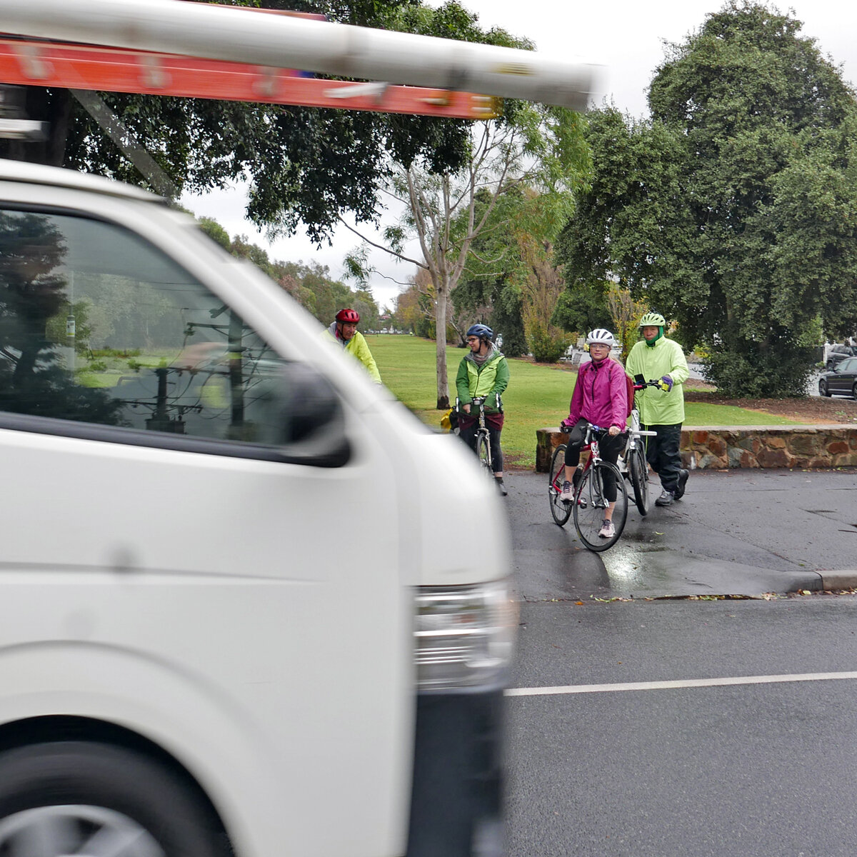
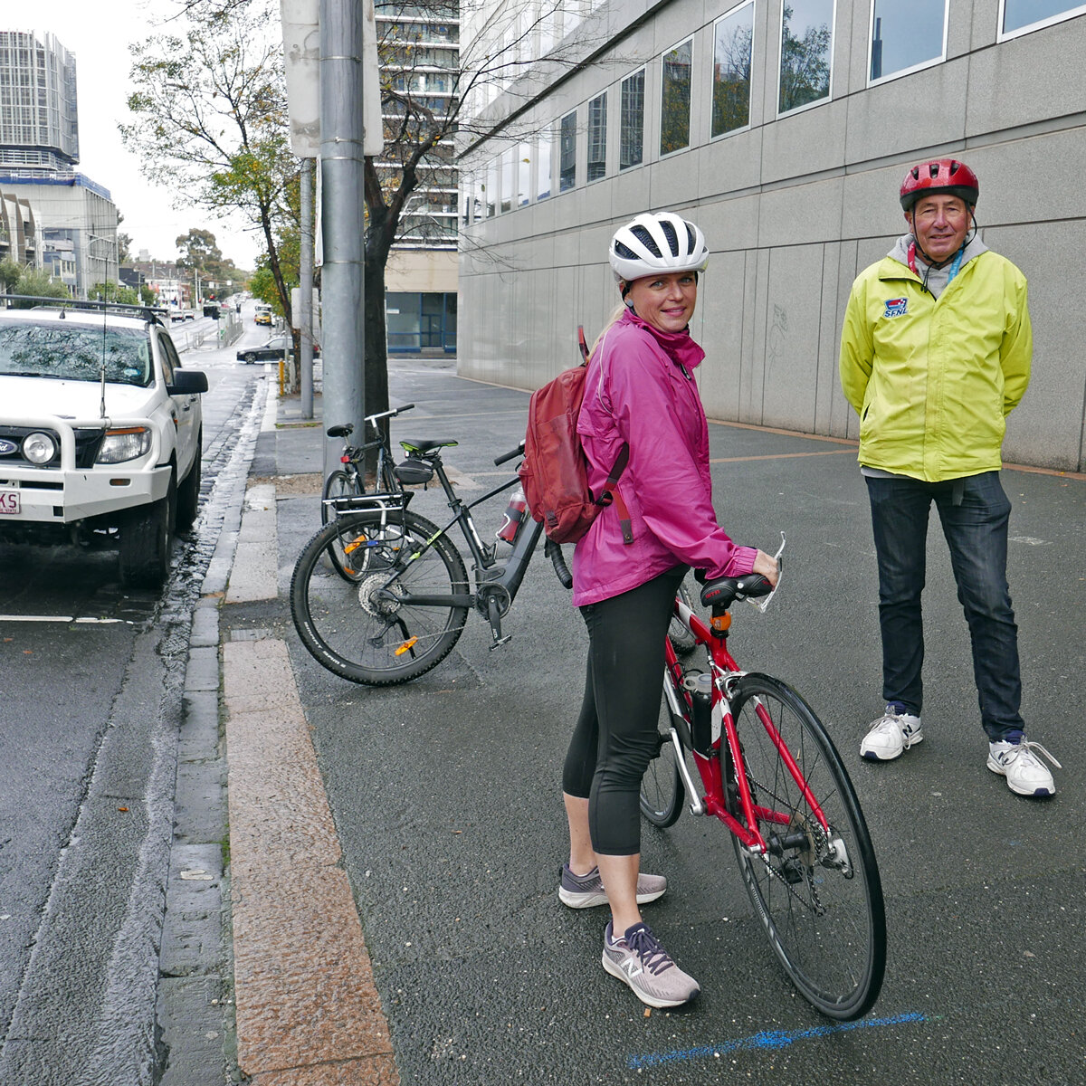
On the 11th May, the BUG took new Port Phillip Councillors Heather Cunsolo and Peter Martin for a ride of Gateway Ward. Or maybe they took us—- they are both at home on their bikes!

BUG members Julie and Pierre with councillors Heather Cunsolo and Peter Martin

BUG members Julie and Pierre with councillors Heather Cunsolo and Peter Martin

Our first stop was the notorious bus stop near the Sandridge Lifesaving Club. This is smack in the middle of the shared path, and the large advertising posters block views of the oncoming bikes and pedestrians, as well as people waiting at the bus stop. We’ve been raising this issue since 2019. In 2020 Councillor Pearl raised it in Council, to which the General Manager replied “"if there is a bus stop that’s causing any safety issues we will report that to the Department of Transport"—- it’s not clear if that’s happened. Our Councillors indulged us by illustrating the safety issues involved.

L1610421.jpg

Next stop, the planned Garden City route. This is one of the protected bike routes from the Integrated Transport Strategy, joining Beacon Rd with Garden City Reserve and then on to the Sandridge Trail via Swallow St. The planned route will include a bidirectional trail on the west side of Beacon Rd and improved crossings on Swallow St. It’s not clear how it will deal with the roundabout between Beacon Rd and the Boulevard.

At the roundabout

At the roundabout

Next stop, the Sandridge Trail. There is still no safe crossing on Bridge St (pictured below), but the new signalised crossing on Ingles St is a big improvement.

No safe crossing of Bridge St

No safe crossing of Bridge St

There was some good news though—- at the tram depot, the Sandridge Trail was closed for works. Apparently the flooding issue (raised repeatedly by BUG members, and also identified in the BikeSpot project) is being addressed, and the notorious yellow railing chicanes are being replaced. The proposed designs look like they’ll be a much better fit for people with trailers, long bikes, or wide bikes.

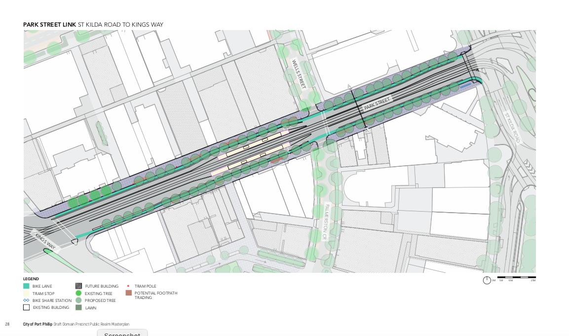
Finally over to Moray St, and Park St, where Council and State Government plan to build protected bike lanes. Between St Kilda Rd and Kingsway, a planned major renovation of the road will include protected lanes. Between Kingsway and the roundabout, Council will put in temporary protected bike lanes. It’s not clear what the final layout will be.

L1610450.jpg

Thanks to Heather and Peter for coming out on a damp and windy morning, we wish you well for your term on Council.

Paint is not protection--- Park St Link

City of Port Phillip has released the first designs for the Park St Link, Route 3 on the planned network of protected bike lanes in the Integrated Transport Strategy (ITS). These designs are part of the Domain Masterplan, now open for consultation, until 14th August 2019.

The Park St Link is a short section connecting St Kilda Road (with its future separated lanes) at Anzac station, and Moray St (Route 3 of the ITS, which has been built as separated lanes to the north, and only “buffered” lanes to the south).

Substantial changes are proposed here, with a new tram line down the street, as well as some street closures.

Context: Park St Link (marked 3) connects St Kilda Rd with Moray St. Full map here.

Context: Park St Link (marked 3) connects St Kilda Rd with Moray St. Full map here.

The eastern section between St Kilda Road and King’s Way shows a completely separated lane, protected from vehicle movements by some kind of curb. The intersection with the minor cross-street, Wells Street, has been dealt with by building up the curbs at the entrance, indicating that the cycle lane and footpath are to have precedence.

St Kilda Road to King’s Way separated lanes

St Kilda Road to King’s Way separated lanes

However the western end of the route, from King’s Way to Heather St, is what the council calls “protected”— that is, it is a green-painted lane with car parking on the left, and vehicles to the right. The “protection” is supposed to be provided by a painted buffer on both sides. Paint will not protect people on bikes from vehicles intruding into the bike lanes. Moreover, a non-separated lane does not provide the high level of safety required to encourage vulnerable or risk-averse potential cyclists.

King’s Way to Moray Street— a non-separated lane.

King’s Way to Moray Street— a non-separated lane.

There is no apparent physical reason why such a mediocre treatment has been proposed here, rather than a Copenhagen style lane with car parking between the bike lane and the vehicle lane. There are very few driveways, with much of the section adjacent to parkland.

Based on the treatment of Moray St, the additional space requirements for a separated cycle lane are as little as 0.5m; however if required, the new tram lanes could be slightly off-set, allowing car parking on one side (as a Copenhagen lane) but not the other.

The closure of Eastern Road is commendable, with extra open space created. There is also a very short section of separated lane between Heather St and Moray St.

On the whole, this treatment fails to achieve its own stated outcome of “A safe, on-road separated bike lane to connect to other bike riding routes, including St Kilda Road, Moray Street and beyond“ (Draft Public Realm Masterplan, page 26).

It also fails to respond to the community, who said:

• Park Street to St Kilda Road is a critical connection for bike riders and needs to be closely considered.

• Big supporter of the separated bike path – following similar models like the ones used in the Netherlands.

• Separated bike path to help improve safety.

(Documented in the Domain Precinct Design Response Community Engagement Report.)

You can respond to the draft plans here—please copy your response to portphillipbug@gmail.com, so we can include your concerns when we meet with councillors. The Port Phillip BUG has also made a submission on behalf of our members.