vicroads

Councillors Ride, Fishermans Bend and Port Melbourne, May 2025

On Friday 30th May PPBUG took City of Port Phillip councillors Heather Cunsolo and Justin Halliday for a bike ride around Port Melbourne and Fishermans Bend.

Cr Halliday, Cr Cunsolo, Julie, Simon, Geoff from Back2Bikes workshop

Fishermans Bend is a suburb in transition— currently industrial, the plan is for employment areas (north of the freeway) and residential (south of the freeway). The challenge is to ensure that the infrastructure for the future uses is in place. A recent Port Places post discussed how this issue was addressed in Port Melbourne 20 years ago.

“If Council wanted people to walk, it had to be safer, especially for children.

Parents with children at kindergarten in Port Melbourne and primary school in Albert Park ran the gauntlet of the Pickles x Liardet and Richardson St intersection daily. In 2005, traffic lights were installed ahead of Becton’s The Park development…. This came about through the patient and tenacious advocacy of council officer Meg Selman to an extremely reluctant VicRoads.”

And in Fishermans Bend:

“Investing in walking will stitch the established residential areas of Port Melbourne to the new residential areas of Fishermans Bend. Communities will grow around the primary school…The gold standard will be when children can make their way independently to school with their parents having confidence that the routes they take are safe. At this stage it seems impossible….But so it did on Pickles St 20 years ago.

City of Port Phillip’s Integrated Transport Strategy 2018—2028 - “Bike riding network improvements” plan for Fishermans Bend and Port Melbourne.

The Victorian Government’s Fishermans Bend Strategic Framework - Cycling Infrastructure Plan

Our route

Points of note on the tour.

Our starting point, the Garden City bike route is one of the few completed Integrated Transport Strategy routes. It’s a shared path, which is no longer considered best practice for well-used commuter routes. There has been some conflict about use of the shared path section. 

Garden City route crossing.

Next, Williamstown Road. Poor amenity for cyclists, with a high level of traffic and unprotected, painted lanes in the door zone. There are two planned crossings — one at Smith Street, near the new primary school; and one at Beacon Road, near the new Fishermans Bend High School and JL Murphy Reserve. But more on that later in the tour.

This is the site for one of the planned crossings of Williamstown Road. On the south side it connects to Leith Crescent and Howe Parade. On the north side is Smith Street and the new Fishermans Bend Primary School under construction. 

Smith St and streetscape outside Fishermens Bend Primary School. This is marked on the ITS as an off-road shared corridor. It connects to the planned crossing of Williamstown Rd to the south, and the planned Strategic Cycling Corridor on Plummer St to the north. Currently carries over 2000 vehicles and 95 trucks daily. Council’s original proposal to modify this to a one-way street ahead of the primary school opening was recently rejected by Council. 

As one councillor pointed out, under the (oddly unconsulted) new option that passed 6-3 at council last month, instead of the previously planned one-way Smith Street version, the median strip (shown) on Williamstown Road is to be closed instead, to prevent half of the heavy traffic from Williamstown Road turning (hastily) into a Primary School precinct. This new option also proposes that these trucks are to be curfewed, but only during school pickup and dropoff times. Yet no one is clear about who will enforce that, and how.

 Smith Street, whilst wide, currently has no footpaths at all, and the nature strip is being annexed by legacy businesses with outdoor seating and a food vendor. The street is a constant two-way flow of large trucks, with commercial vehicles dominating the parking places.

Plummer St has no on-road cycle lanes, but presents wide nature strips for possible off-road shared paths. This is something that an earnest council could consider as a way to tick a planning box, draw on State funding and Developer Contribution Fund revenue, and maybe also save lives. As the road is a State responsibility, currently Council claims no mandated role to fix the situation. But they do have one as an advocate to State, a partner in Fisherman Bend urban renewal, and they also have planning powers.

Plummer St is a Strategic Cycling Corridor (East-West), but certainly isn’t safe. It is also a designated “truck by-pass” upgraded by Vicroads to try to move Webb Dock bound trucks off Williamstown Road. It is also the site of a recent cycling tragedy. 

Next, Salmon Street and the Salmon Street Bridge. Salmon Street is a Strategic Cycling Corridor (North-South). The ITS shows many planned active transport crossings of the freeway, connecting the future residential and employment centres of Fishermans Bend. These are Todd Rd, street west of Salmon St, Salmon St (connecting to Smith St), Douglas St, Graham St, Ingles St. With the exception of Todd St, these are non-existent or highly dangerous. Currently conditions on Salmon St are extremely inhospitable for people on bikes.

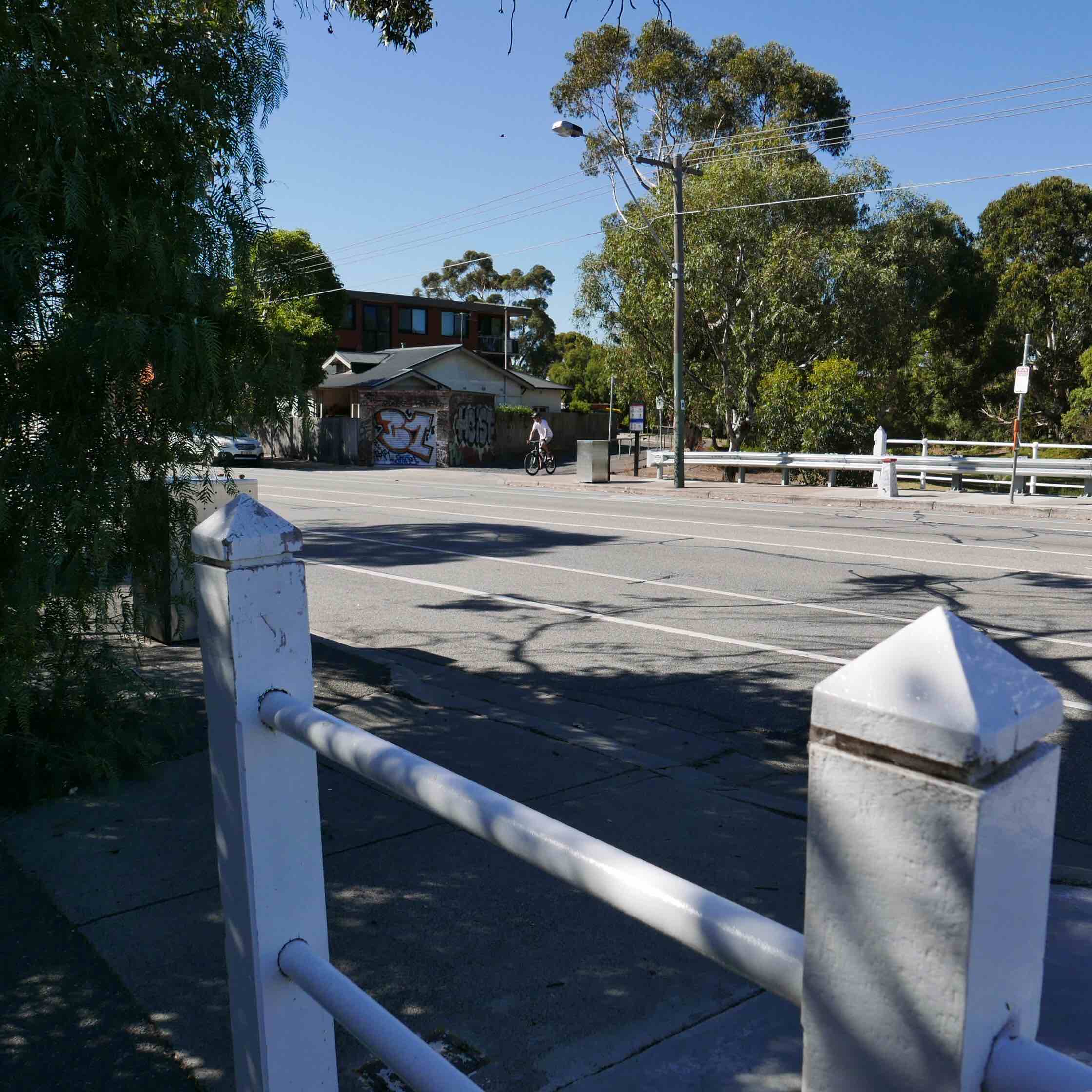
Salmon St bridge has a dangerous grate halfway down the road.    The only alternative is a very narrow footpath on the north side (left side of left photo), only accessible by narrow steps.      

One Active Transport solution floating about is to install a shared path cantilevered from the side of the bridge, as had been done in many other localities around the world. Council, through its very ambitious Integrated Transport Strategy, has suggested building a lot of new shared path bridges over the M1. Here is one project that already has the supporting structure in place.

The Salmon Street Bridge from the City of Melbourne side. Note that City of Melbourne have installed bike lanes - both on and off-road - following the Strategic Cycling Corridor. But they abruptly end at the bridge and the municipal boundary. Call it the Vegemite gateway to Port Phillip.

 Next on the tour, we’ll have look at what the City of Melbourne are doing about getting on with the job of building the better infrastructure needed for a new Fishermans Bend. 

Salmon Street off-road shared path (City of Melbourne) approaching the Skills Precinct. The Fishermans Bend Skills Precinct (University of Melbourne campus under construction) where Salmon Street meets the new Turner Street off-road shared path (City of Melbourne).

The Fishermans Bend Urban renewal precinct is split by the municipal boundary, being the M1 Freeway, with only limited crossing points. Both councils have an important job to do in making plans a reality, connect communities, or they could end up with an unlivable mess of people living in isolated developments with deadly roads and no green space. 

It also seems that each council is going at a different speed.

Turner Street.  A City of Melb project—- a reasonable bidirectional path, made of permeable paving, which deals fairly well with many driveway crossovers.

All driveway crossovers on the new City of Melbourne Turner Street off-road shared path feature rumble strips for cyclists, and speed bumps and signage for vehicles. The landscaping screens out the road to improve the visual experience, and includes seats and tables. It will improve as the trees grow, which is good planning vision.

The Turner Street off-road shared path ends under the Bolte Bridge, where the off-road path turns north towards the river, crosses Lorimer Street and connects with the South Wharf promenade, the CBD and on to the Yarra River trail.

The next “Gateway to Port Phillip” that we investigated is the Ingles Street Bridge. Like the Salmon Street one, it’s a narrow and dangerous crossing for people on bikes, though at least there is access to a footpath on one side.

View from the top of the Ingles Street Bridge over the M1 to Southbank and the CBD. Both the Salmon Street and Ingles Street Bridges have great views, which support ideas that have been floated of creating a highline type project, removing a traffic lane to create a wide landscaped promenade, encouraging people to visit and recreate. Now that could be a great ‘Gateway to Port Phillip’.

This is the Montague Street gateway to Port Phillip: a series of pedestrian crossings under the M1 and crossing the multiple Freeway off-ramps located here. The crossing timings are short, the safety islands are small, and the traffic coming off the freeway is moving heavy and fast. There have been deaths and injuries here when pedestrians and cyclists have been caught short, or rushing drivers blow through red lights.

South Wharf Car Park Connector Path:   a poorly signposted back route around the South Wharf building. 

Once upon a time there was a more direct and scenic route from Pollywoodside to the Sandridge Trail, between Jeff’s Shed and the Convention Centre. When South Wharf was extended the bike route connection became an annoying afterthought to the developers. 

The resulting maze of a route arbitrarily weaves its way around parked cars and freeway pylons. The lighting is poor, which discourages many at night. And the signage is faded or non-existent. If you find yourself lost trying to find your way through here you are not alone. Many people can’t even find where it starts for lack of signage. 

It would be great if the shopping centre operator cared to improve and maintain this route, especially as it is on leased public land. Yet another gateway to Port Phillip that needs attention.

The Melbourne end of the busy Sandridge Trail at Southbank Tram Depot. Wayfinding signage is lacking, relying on prior route knowledge rather than highlighting a transport gateway.

During a previous councillor ride in this ward, PPBUG raised community concerns about the chicanes on the tram track crossovers at either end of the Depot, advocating for wider placement to allow a smoother and easier flow of bikes and pedestrian traffic. It’s good to see the new ones in action - just watch out for the trams!

The shared path along Normanby Road, here at the edge of Port Phillip, is quite rooted by trees: bumpy with a blind corner around a pylon to add to the adventure. It needs an upgrade. 

[IMAGE BELOW] You notice when the path crosses the municipal boundary, City of Melbourne’s side is newer, wider, more solid and flat.

This part of the Port Phillip - City of Melbourne boundary also has crossovers at Southbank Depot Tram Stop with access to South Melbourne Primary School, the new Kirrup Park precinct and Ferrars Street; and further down the path is the Whiteman Street gateway (pictured) to the popular Cecil Street bike path through South Melbourne and beyond.

Shared paths give a wide range of transport options, including to mobility scooter users pictured here under the freeway.

Back to Bikes on Williamstown Road in council owned premises that they are required to soon vacate.

Geoff from B2B accompanied our ride and updated us on the search for a new workshop for this amazing community group. Councillors on the ride assured us of their efforts to help find a new home. Check out Back2bikes workshop.

Next on the tour, the scene of the crime: Bridge Street, Port Melbourne. This was one of the Port Phillip streets chosen for the State Government’s Pop-Up-Bike-Lane projects a few years ago. It was also the subject of some vitriol and rage from a few in the community and in the wider culture wars. As a result, many of these temporary bike lanes became past tense. 

Bridge Rd/Williamstown Rd

One bit of infrastructure to disappear was this safety lane here at the corner of Bridge Street and Williamstown Road. The now-gone curb blocks stopped cars from running over bike riders as the cars turned left, craning their heads to see oncoming traffic from the right. Nowadays it is a brave bike rider that risks riding into that space.

The new Fishermans Bend High School, on the corner of Plummer Avenue and Graham Street. It’s a very important piece of State Government infrastructure for the community in this urban renewal precinct. 

And they have installed some bike hoops as part of the build. Perhaps for decoration as there are no bike paths leading to this school. There are no curb cuts for exiting the traffic on dangerous Plummer Avenue. There are not even pedestrian crossings on both corners of the school (as shown).

It seems that a lot of students cut across JL Murphy Reserve to access the school. There are tracks, but no connected bike paths. And then we get to Williamstown Road on the other side of the Reserve, and there is not even a footpath along the road. 

It is like the High School dropped from the sky and council doesn’t quite know how to connect it to the rest of the community. There is great opportunity for Council to be a hero here. JL Murphy Reserve does not have to be just about sports fields, there is space between the fields.

[IMAGE BELOW] At Williamstown Road there is a plan to install a pedestrian crossing (mentioned earlier) right here. It will connect JL Murphy Reserve to Beacon Road in Garden City, and on that will be one day the new Federally funded bike path-lette. Currently, students by the score just dash across four lanes of heavy traffic (as shown below) before and after school. 

Site of planned crossing, Williamstown Rd.

We cross the road ourselves and here we have - at the end of our tour - the aforementioned Beacon Road. The Beacon Road Bike Path was one of many Active Transport projects announced for funding by the Federal Government’s Department of infrastructure just before the recent Federal Election. The $515,000 (or $550,000 depending on who is telling it) is for a 320m stretch of protected bike lane that will run from Williamstown Road (and the new pedestrian crossing that will be one day installed) and connect to the Beacon Cove Bike Path. When it eventually happens it will be a very welcome connector conduit in our city’s Active Transport network.

The Beacon Road Bike Path is just one of many parts of the network. Every part of a network is important.

Some have said that small sections of bike path are not worth the tax dollars, the rates, the lengthy consultation process, the push back from legacy businesses (and their lobbyists), nor the political juice required. “A bike path from nowhere to nowhere” said one council voice on a small shared path project recently contested (Smith St). Every link is followed by another. And if they are all eventually joined up, and the plan is completed, then communities get connected, and people can live better. 

Thanks Councillors for your time and willingness to listen! We will be repeating this ride with some of the other Councillors in a few weeks time.

Relevant planning documents and other links:

Move Connect Live: City of Port Phillip’s Integrated Transport Strategy 2018—2028

Fishermans Bend Framework

Strategic Cycling Corridors in Victoria.

Walking in Port Melbourne and Fishermans Bend A blog post by friend-of-PPBUG Janet Bolitho

Back2Bikes workshop

Kerferd Rd bike lane (update April 2023)

TAKE action:

Write to your representatives! contact details are here.

The history

2018: The City of Port Phillip’s integrated transport strategy Move Live Connect designates Albert/Kerferd Roads as a priority bike route. CoPP prepares a Kerferd Rd safety trial, including a protected bike lane, supported by extensive traffic modelling.

However in the 2018/19 budget, the State Government committed $13m to the Shrine to Sea project, upgrading the Albert Rd/ Kerferd Rd boulevard including active transport links.

In the face of this, the Council decided not to proceed with their own trial.

The Shrine to Sea project has proceeded glacially, with extensive community consultation.

Over 2020-2021, a community panel met, considered evidence from subject matter experts, and together developed a vision for the boulevard. Among a suite of thoughtful recommendations: “Bike lanes to be interconnected for the entire length of the boulevard; Use landscaping to define a separate bike pathway on Kerferd Road to isolate bikes from cars.

Kerferd Rd bike lane, 2020

Pop-up lanes project

In 2022, VicRoads announced that as part of their pop-up bike lanes project, “40km of new and protected bike lanes” would be installed in the City of Port Phillip. Most of this was so-called “light touch” measures: renewing paint on existing on-road lanes, wayfaring signs, and speed humps.

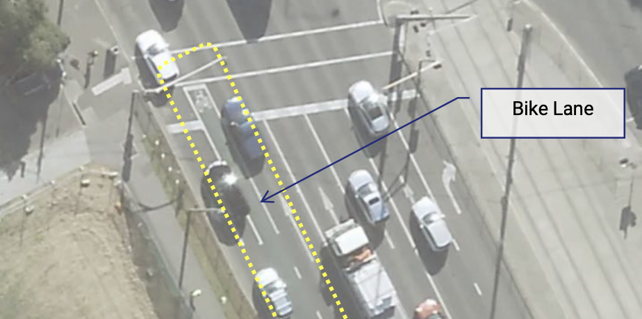
The single substantive measure was a trial of a parking-protected bike lane on Kerferd Rd, between Richardson St and Canterbury Rd. This would include a bollard protected bike lane under the light rail near the Albert Rd/Canterbury Rd intersection. Protection from cars is essential on this stretch of road, as can be seen in the photo below.

In April 2022 VicRoads announced that following “community consultation” the trial would not go ahead.

View of the road under the light rail line, with a car partially driving in the bike lane.

Google streetview of lightrail underpass, showing a vehicle veering dangerously into the bike lane

Current situation:

The Shrine to Sea team is supposed to be releasing a draft plan in “early 2023”. They have been evaluating “5 different bike lane and road configurations”. As this is a Council road, council’s support is required for the project to go ahead. While some councillors have made their support for a protected bike lane clear, others are opposed to any changes. The support of Mayor Heather Cunsolo, who “talks the talk” on cycling, will be crucial.
Planning context

Kerferd Rd is an extraordinarily wide boulevard. At about 60m wide, it is similar to St Kilda Road, but has no tram lines or high density buildings. Few inner city streets offer such ample space for introducing simple safety improvements. There are two vehicle lanes in each direction, a very wide grassy median and a mix of angle parking and parallel parking against the curb. There are almost no driveways. After Canterbury Rd the boulevard is called Albert Rd, and runs alongside Albert Park, with service roads for much of the length. At the south-west end is the sea, at the north east end is the Shrine of Remembrance and the Domain. There are extensive sporting facilities in Albert Park, and nearby schools include Middle Park Primary, Albert Park Primary, South Melbourne Park Primary, and MacRob Girls High School.

Kerferd Rd is not a VicRoads declared road although Albert Road is. The Albert Rd/Kerferd Rd route is a State Strategic Cycling corridor, which are “the most important routes for cycling for transport”.

A map of strategic cycling corridors, showing Kerferd Rd

Strategic cycling corridors, December 2020

Albert Rd/Kerferd Rd is route 2 on the City of Port Phillip’s bicycle network, and has been identified as a high priority by Council for many years.

The need

Council’s original plan for Kerferd Rd identified the need for improvement here:

Kerferd Road has a very high number of crashes compared to other Council-managed roads in Port Phillip. Between 2016 and 2020, there were 24 recorded crashes along Kerferd Road. Of these, 11 involved cyclists; three received serious injuries. This site has the second highest number of crashes in the City of Port Phillip. This crash data has been provided by the Road Crash Information System (RCIS). This system is maintained and operated by the Department of Transport and Victoria Police.

Kerferd Road is a key link for bike riders and connects the Bay Trail bike path to the off-road paths in Albert Park Reserve, the new Anzac Station and to the proposed upgraded bike facilities on St Kilda Road and Moray Street.

Strava heat map shows high use  by cyclists

Heat map from Strava shows existing heavy bike use of Kerferd Rd, similar to St Kilda Rd or Beaconsfield Parade

What the experts say

Separated bike lanes are essential for better mental and physical health: the Heart Foundation says that Victoria should be investing in separated bike lanes improve health, as well as support local businesses, save households money, and provide independence and freedom, especially for children, teenagers, the elderly and people with a disability. They estimate that $13 would be returned in value for every $1 spent.

Separated bike lanes make financial sense: Infrastructure Victoria says “if we provide alternatives that get more cars off the road, everyone benefits. For drivers, it means less time in traffic and travelling to the city becomes a better experience. For everyone else, the environmental and productivity benefits are huge.” An increase of 55% of people choosing to cycle is achievable and could save every inner Melbourne car driver around 18 minutes in traffic per week.

People with disabilities need bike lanes to get scooters off the footpath: Vision Australia advocacy manager Chris Edwards said vision-impaired Victorians were concerned about being hit by riders or tripping over parked hire scooters. “[In] our view there’s not the infrastructure that supports [scooters] – bike lanes, appropriate places where you can park the scooters so they’re not a hazard – still hasn’t caught up. Without [that]... they’ll be an ongoing issue.” Age article, Jan 2023.

Community views

Broad-based surveys of Port Phillip residents consistently reflect support for protected bike lanes (the pop-up painted bike lanes by the DoT in 2022, on the other hand, were controversial). For example, the most popular element of Council’s Integrated Transport Strategy was “Deliver a network of dedicated and continuous priority bike lanes to create safer routes for all ages and abilities”. Surveys completed in 2018 by the City of Melbourne found that 83% of respondents living in Melbourne and adjacent municipalities (including City of Port Phillip) would aim to ride if a protected bike lane was provided compared to 22% who say they would be confident to ride on conventional painted bike lanes (without buffers).

More community views (from Heart Foundation, Victoria Walks, PECAN, and others) in a joint statement here.

The concerns raised by the anti-bike lane lobby include: “Safety - a bike track between the walking path, nature strips and the road, puts the residents at risk of tripping over the concrete bollards. Many residents along this road are elderly and transition from car, pathway and then into their property and they would be at more risk if this plan goes ahead.  Duplication - There is already a bike path for our 'much loved' bike riders. Even bike riders will not benefit from these changes. Parking - Albert Park residents pay a fee to the City of Port Phillip council to park out the front of their own homes. Yet, this plan will reduce current parking for Kerferd Rd residents.  Traffic chaos- Kerferd Road currently does not have any traffic issues. One lane WILL cause traffic to bank up at the lights at Beaconsfield Parade. Expenses - it is believed that finance (in excess of $12-16m) has already been earmarked for this project with the Victorian State Government. “

These claims are either entirely without evidence, can be mitigated by good design, or are just the cost side of the ledger, without considering the benefit side. For example: while some car parks may be lost over a rather long stretch, car parking has been prioritised under most suggested plans, and almost all of it will be retained. For example: Kerferd Rd does have traffic issues, not only the safety issues mentioned above but also hooning. Traffic modelling specific to Kerferd Rd indicates that reducing the road to one lane will not induce “traffic chaos”. For example: the expense of cycle lanes is off-set by improved public health, reduced traffic congestion, improved air quality, and reduced greenhouse emissions.

So called "independent expert report" on pop-up infrastructure trial is neither independent, nor expert.

 Summary: A so-called independent report claims to find that the pop-up trial of bike infrastructure is dangerous and should be removed. It is a privately commissioned piece of political advocacy that is neither transparent nor comprehensive, contains egregious errors throughout, and offers opinions not based on actual data or best practice knowledge. We stand by our call for the trial to run to completion, with a comprehensive data-driven review before deciding whether to keep or remove the changes.

Update: Since writing this article, some of our questions about the Traffix Report have been (partly) answered by PS Media article 25 November. So we suggest reading this first: https://news.psmedia.com.au/port-phillip/news/articles/2511-pop-up-bike-lane/


While the range of infrastructure implemented across 38 km of city streets is a bit of a mixed bag, our user experience survey and consultation identified no immediate safety issues [1]. We look forward to a full and proper review based on robust data at the end of the trial period.

RoPP-Traffix Report

The following is our review of the ‘Port Phillip ‘Pop-up’ Bike Lane Infrastructure Independent Transport Review’ by Traffix Group consultants, dated 27 October 2022 from the Ratepayers of Port Phillip (RoPP) Facebook page.

The Traffix report is partisan, not independent

The so-called "independent" Traffix report does not meet basic criteria for independent expert reports, such as the requirements listed in VCAT Practice Note for Expert Evidence.


The commissioning of the report lacks transparency and accountability. The report does not clearly state its funding sources, aims, methods, limitations, and assumptions. The Traffix report reviews only a small number of isolated sites within the 38 km pop-up trial and so can hardly be considered a comprehensive assessment. Yet, this does not stop the conclusion making sweeping recommendations about "the vast majority of the pop-up bike lane infrastructure.”


The consultant and client have worked together to form a closed feedback loop. An example of this can be seen in the Traffix report citing "community reporting" of "confused motorists" as a significant safety issue, which is then promoted by the RoPP spokesperson on their website and to the Nine media to claim an "independent" report has raised significant issues for motorists.


We conclude that Traffix are acting as an advocate for the political lobby group RoPP and that it is misleading to refer to their report as “independent”.


Misinformation Campaigns

If the RoPP political group had commissioned the report to address genuine safety concerns, they would have submitted it to the local and state governments for immediate action, instead of promoting it to the media.

 Like other conspiracies cooked up on facebook groups, it is alarming that real community safety issues are being deliberately misrepresented for political gain. For example, the "independent" Traffix report has been used by RoPP to try and wedge candidates for the state government election, refer to RoPP reporting on Albert Park candidates forum.

Safe cycling infrastructure

Central to all of the Traffix report's key findings and recommendations, is the fallacious opinion that "conventional" bike lane infrastructure (paint) is safer than physical separation. This opinion is directly contradicted by evidence from extensive research in Australia and internationally, such as:

·     The Conversation: 3 in 4 people want to ride a bike but are put off by lack of safe lanes

·     Separated bike lanes means safer for all users of the road: 13 year study across a dozen cities 

At Park Street, for example, Traffix consultants tie themselves in knots on this issue: acknowledging the new separated lanes are a clear safety improvement, yet also recommending extensive modifications to convert them to “conventional” painted lanes.

The image shows an unprotected bike lane between two lanes of car traffic.

The Traffix report recommends this as best practice….

Traffix also makes an overly big deal about conflicts with left-turning lanes at the newly separated intersections on Marine Parade and Park Street, even though these conflict points now occur at much lower speeds. Traffix asserts that minor concerns like this make the entire separated trial unsafe for motorists and cyclists: this is not just over-egging the issue, it is directly contradicted by the extensive research cited above.

 We strongly support the retention of the Park Street pop-up separated bike lanes. We love the new St Kilda Road separated bicycle lanes and we look forward to the Kerferd Road separated lanes being implemented as part of the Shrine to the Sea project.

Traffic Congestion

The Traffix report does not find that the pop-up trial exacerbates traffic congestion, despite this being claimed by a RoPP spokesperson on their website. To be clear, the report does not make any findings or recommendations on the issue of traffic congestion and for RoPP to claim otherwise is blatant misinformation.

Motorist Safety

The report’s conclusion claims that the overall trial offers "an increased risk to road users" including “motorists”, yet evidence in the report in support of this for this bold claim is scant.

 The report's review of separated bicycle infrastructure greatly exaggerates the increased risk of conflict between bicycles and cars, as noted above for Marine Parade and Park Street.

 The report erroneously does not identify the asymmetric nature of conflicts between bicycles and cars, with the person riding the bike obviously much more at risk than the driver and occupants of the vehicle. Deliberately conflating the two risks as being equivalent is a misrepresentation of road safety issues.

The "community reports" of "confused" motorists driving on new separated bicycle lanes in Marine Parade is most likely a teething issue associated with the introduction of new infrastructure. There is no data supporting Traffix’s claim that the bicycle lanes pose any continuing safety risk to motorists. There is also evidence that the risk to cyclists is far greater for painted bicycle lanes than for separated lanes.

 The report only identifies one isolated instance of increased risk to motorists, which relates to the circumstances at Deakin Street in St Kilda West. In this case, the report identifies some simple ways to mitigate the increased risk, namely adding a painted centreline and road narrowing warnings. However, the report fails to mention these safety solutions, or any others, in its findings and recommendations. This is an extraordinary omission for a "safety" report! Given Deakin Street's wide pavements, low traffic speed and low traffic volumes, there are many simple safety solutions that could work well for all road users in this space.

 Who is cycling infrastructure for?

Traffix's strong preference for painted bike lanes reflects outdated engineering assumptions that all cyclists are fit, adult males in lycra. As per the research cited in The Conversation, 3 in 4 people want safe cycling routes, which particularly for women, means separated cycling infrastructure.

There is community demand for safe cycling routes that better suit a wider demographic: parents doing the childcare drop-off on the way to work, kids cycling to school, families going to the beach, and seniors who like getting around by bike 'cos it's easier on the old knees' than walking. 

 Marine Parade

Marine Parade is a central part of one of Melbourne's most popular and iconic on-road cycling routes. The road has well-known safety issues, including at the intersections targeted by the pop-up trial. We therefore disagree with Traffix's recommendation that targeting safety improvements at these notorious intersections is not worthwhile. As with the rest of the trial, we look forward to a complete review being made at the end of the 12-18 months period when more data is available. 

 Apart from intersections, we note the other significant safety issue for cycling on Marine Parade is the lane interruptions by on-street parking, such as at Donovan's restaurant and at Catani Gardens.  We would welcome RoPP making a positive intervention to address these issues, rather than the crocodile tears on display here.

Get off the Road!

For the section of Marine Parade between Fitzroy Street and Glen Huntly Road, Traffix claims that the ‘pop-up’ bicycle lanes on Marine Parade “are in locations where there is already an existing two- way off-road bicycle path that runs parallel to Marine Parade adjacent to the western side of the road. This path is fully separated from traffic.”  (As an aside: professional traffic engineers ought to know the difference between a shared user path and a bicycle path).

Apart from the middle third, this statement is incorrect for the majority of this 2.2km section, because:

a.      in the southern section, from Dickens St to Glenhuntly Rd, the off-road path detours through the marina car park – where it is a shared path with pedestrians – and then makes a long detour around Moran Reserve and Point Ormond. There is no direct connection to Glenhuntly Road from the Bay Trail.

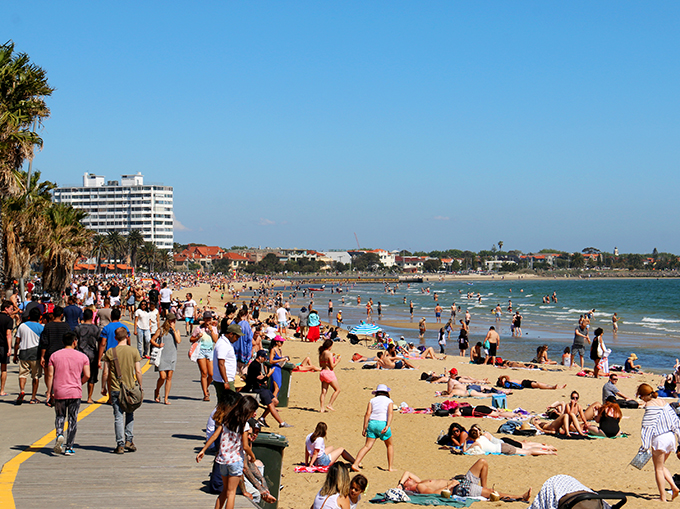
b.     in the 850m long northern section, from Shakespeare Grove to Fitzroy St, there is no two-way off-road bicycle path at all. The popular St Kilda foreshore promenade is a shared cyclist-pedestrian space. This section is a high accident zone between pedestrians, cyclists and scooters. At its busier times, the crowded promenade is not a safe place for riding bicycles or scooters.

This is what Traffix and RoPP call an “off-road bicycle path”

 Traffix’s recommendations that no safety improvements for cycling infrastructure is required for Marine Parade appears to be based on their false belief in a safe and equivalent off-road route. This incorrect assumption is repeated by RoPP on their website: “The report also notes an existing bike path completely separated from Marine Parade traffic has already been in place for many years, raising questions about why new infrastructure is needed.”

 In summary, both RoPP and Traffix recognise that the popular Marine Parade cycling routes are unsafe. However, they do not recommend any safety improvements because cyclists should just get off the road!

Visual Amenity

Making "visual amenity" a key recommendation in a "transport safety review” is highly unusual but reflects the RoPP tactic of conflating “amenity” with “safety” issues. Why else would "independent" transport engineers be so troubled by orange paint, which is the standard colour for temporary road works? “Visually uncluttered” places like St Kilda Junction are paradise to traffic engineers but deadly to cyclists!

 While we agree that permanent garden beds are preferable to temporary concrete blocks, and white paint is preferable to temporary orange paint, we are quite happy to wait until an independent safety review at the end of the 12-to-18-month trial for any final decisions to be made.

 Pedestrian Safety 

We welcome the Traffix report's findings that the pop-up trial improves pedestrian safety at many intersections. However, we completely disagree with the recommendations that pedestrian safety improvements are "irrelevant" and should be removed. We recognise that pedestrians are the most vulnerable users of public spaces and must be considered as a priority in all decisions around road safety. 

 Incremental safety improvements

Despite finding that some trial interventions have overall safety benefits, Traffix still recommend their removal because "not every intersection has that treatment". This is illogical.

 Speed Humps

We support the introduction of speed humps to reduce vehicle speeds in residential streets, as they can improve safety and amenity for the entire community. We note some fine-tuning of placement and design may be necessary in a few places, particularly to avoid vehicles swerving around the speed humps.

 Sharrows

Painted sharrows offer little safety benefits to cyclists, but we are happy for the permanent status of this paintwork to be reviewed at the end of the trial.

 Wasteful Governance

The RoPP group claim to support fiscal responsibility, yet in practice are promoting the wasteful removal of temporary infrastructure based on flawed reasoning and incomplete data.

 Inherent Limitations of the Pop-Up Trial

Given the narrow parameters of the pop-up trial roll-out – doing what is quick and easy, rather than what is necessary – we note that wider safety issues have not been addressed in the trial. For example, in some targeted locations, removing or relocating on-street parking spaces would greatly improve safety much more than the pop-up installations.


[1] We note that members of BUG have since documented concerning incidents on Westbury St that should be investigated as soon as possible. The information has been passed on to the DoT Pop-up Trial team for action.

We need a protected bike lane trial on Kerferd Rd

The history

2018: The City of Port Phillip’s integrated transport strategy Move Live Connect designates Albert/Kerferd Roads as a priority bike route. CoPP prepares a Kerferd Rd safety trial, including a protected bike lane, supported by extensive traffic modelling.

However in the 2018/19 budget, the State Government committed $13m to the Shrine to Sea project, upgrading the Albert Rd/ Kerferd Rd boulevard including active transport links.

In the face of this, the Council decided not to proceed with their own trial.

The Shrine to Sea project has proceeded glacially, with extensive community consultation, and a draft design expected to go out for consultation in 2022.

Kerferd Rd bike lane current condition

Pop-up lanes project

In 2022, VicRoads announced that as part of their pop-up bike lanes project, “40km of new and protected bike lanes” would be installed in the City of Port Phillip. Most of this was so-called “light touch” measures: renewing paint on existing on-road lanes, wayfaring signs, and speed humps.

The single substantive measure was a trial of a parking-protected bike lane on Kerferd Rd, between Richardson St and Canterbury Rd. This would include a bollard protected bike lane under the light rail near the Albert Rd/Canterbury Rd intersection. Protection from cars is essential on this stretch of road, as can be seen in the photo below.

In April 2022 VicRoads announced that following “community consultation” the trial would not go ahead.

View of the road under the light rail line, with a car partially driving in the bike lane.

Google streetview of lightrail underpass, showing a vehicle veering dangerously into the bike lane

Planning context

Kerferd Rd is an extraordinarily wide boulevard. Few inner city streets offer such ample space for introducing simple safety improvements. There are two vehicle lanes in each direction, a very wide grassy median and a mix of angle parking and parallel parking against the curb. There are almost no driveways. After Canterbury Rd it becomes Albert Rd, and runs alongside Albert Park, with service roads for much of the length. At the south-west end is the sea, at the north east end is the Shrine of Remembrance and the Domain. There are extensive sporting facilities in Albert Park, and nearby schools include Middle Park Primary, Albert Park Primary, South Melbourne Park Primary, and MacRob Girls High School.

Kerferd Rd is not a VicRoads declared road although Albert Road is. The Albert Rd/Kerferd Rd route is a State Strategic Cycling corridor, which are “the most important routes for cycling for transport”.

A map of strategic cycling corridors, showing Kerferd Rd

Strategic cycling corridors, December 2020

Albert Rd/Kerferd Rd is route 2 on the City of Port Phillip’s bicycle network, and has been identified as a high priority by Council for many years.

The need

Council’s original plan for Kerferd Rd identified the need for improvement here:

Kerferd Road has a very high number of crashes compared to other Council-managed roads in Port Phillip. In the five-year period ending in June 2017, there were 25 recorded crashes on Kerferd Road that resulted in injury to bike riders, drivers and pedestrians.

  • 15 crashes resulted in injury to bike riders

  • 1 crash resulted in injury to a pedestrian

  • 10 crashes caused serious injuries

Kerferd Road is a key link for bike riders and connects the Bay Trail bike path to the off-road paths in Albert Park Reserve, the new Anzac Station and to the proposed upgraded bike facilities on St Kilda Road and Moray Street.

Strava heat map shows high use  by cyclists

Heat map from Strava shows existing heavy bike use of Kerferd Rd, similar to St Kilda Rd or Beaconsfield Parade

What the experts say

Separated bike lanes are essential for better mental and physical health: the Heart Foundation says that Victoria should be investing in separated bike lanes improve health, as well as support local businesses, save households money, and provide independence and freedom, especially for children, teenagers, the elderly and people with a disability. They estimate that $13 would be returned in value for every $1 spent.

Separated bike lanes make financial sense: Infrastructure Victoria says “if we provide alternatives that get more cars off the road, everyone benefits. For drivers, it means less time in traffic and travelling to the city becomes a better experience. For everyone else, the environmental and productivity benefits are huge.”

Community concerns

Many community concerns were raised about the trial, include a scaremongering petition that was circulated claiming that the trial would “mean a loss of parking spots, a bike lane (where one already exists) and using ugly concrete bollards between the nature strip and the parked cars”.

From the anti-bike-lane-petition.  Reasons for signing "My cat loves to walk down the road freely and without a care in the world.  NO CHANGES TO KERFERD RD"

Screenshot from the anti-bike lane trial petition

Rather than respond to these concerns with either modifying the design or by correcting misinformation, or even by pointing out that a trial would give everyone the chance to identify issues and correct them, VicRoads abandoned the project.

Sign ouR Petition to Local Member of Parliament, Minister Martin Foley, and Roads Minister, Ben Carroll.

In our petition, we ask for the re-instatement of the trial. This will allow any issues to be addressed ahead of the planned installation of permanent, separated bike lanes in the Shrine to Sea project.

Safe space for cycling and walking

Proposal: that the City of Port Phillip and VicRoads install pop-up bikes lanes on key routes to ensure safe distancing during exercise and commuting. We also request that Council widens footpaths in well-used shopping streets to allow safe space for walking.

During the pandemic shut down, we’ve seen popular recreational routes (such as the Bay Trail) become quite busy, with poor prospects for maintaining social distancing.

As we consider easing restrictions and returning to work, maintaining social distancing on public transport will be challenging and by some estimates, will reduce capacity by 90%.

In order to ensure safe exercising now and safe commuting in the future, we are asking CoPP to install temporary bike lanes with bollards, water barriers, or even by just removing parking lanes.

Precedents: This has been implemented extensively overseas in cities such as Berlin and Milan, and also by the City of Melbourne.

Supporting council’s long-term transport planning: The routes we suggest below are either State strategic bike routes, or part of the Council’s planned bicycle network. Pop-up bicycle lanes in these locations would support a more informed consultation process when the time comes to consider making them permanent.

Suggested routes: Prioritise routes that are popular for recreation, key commuter routes, or routes where there are ample alternatives for car parking or vehicle traffic, and routes that join up with City of Melbourne improved routes.

  • Beach Road/ Marine Parade/ Beaconsfield Parade: This is a popular com- muter cycle route, yet on the beach side there is no continuous on-road bike lane, and on the other side, it is in the door zone. Even with reduced motor traffic volumes, it is unsafe. Furthermore, installing a pop-up bike lane would take pressure off the parallel Bay Trail, which has become very crowded with joggers and recreational cyclists. This could easily be done by re-allocating the clear way/car parking along Beaconsfield Parade into an on-road bike lane, protected by temporary bollards.

  • St Kilda Rd: A key commuter route, and one that was recognised by the RACV Strategic Cycling corridor review (January 2019) as offering the most potential for meeting the objectives of the Victorian Cycling Strategy. Again, this could be easily done by removing car parking, or reallocating a traffic lane.

  • Chapel St: Another important commuter route recognised by the RACV review, and one where the car parking could be removed to form a bike lane.

  • Albert Rd/ Kerferd Rd: There are plans for separated bike routes (with State government agencies leading), but in the meantime temporary bike routes can be installed. Council has already made extensive traffic studies of this route.

  • Moray St: An important commuter route connecting to the City of Melbourne. This has protected cycle routes on half its length already.

Safe space for walking: We also suggest widening footpaths in well-used retail areas. As cafes and restaurants have moved to take-away only, on our narrow streets it’s difficult for customers to queue while leaving room for pedestrians to safely walk past.

  • Allow shop owners the option of reserving curbside car parking areas directly in front of their shops as "safe space for standing" zones, marked off by bollards or the like.

  • Re-allocate curbside carparks in retail streets with narrow footpaths to walking. Suitable streets here include stretches of Carlisle St, Bay St, Barkly St, and Ormond Rd Elwood.

Councillors' tour of bike infrastructure in the Canal Ward

On Thursday 8th March we took Councillors Katherine Copsey, Tim Baxter and Dick Gross for a tour around the Canal Ward to look at the infrastructure that makes riding a joy... or a nightmare.  (Handout with map and site descriptions here.)


8.35km

It was a beautiful day for a ride!

town-hall.jpg

We observed the absence of a safe crossing on the Canal path at Glen Huntly Road.

glen-huntly.jpg

And discussed the promised counter-flow bike lane on Blessington St--- when will this happen?

blessington.jpg

Thanks to our hard-working councillors Dick, Katherine and Tim, and to Simon for the photos, and to our volunteers Georgie and Rochelle for keeping everyone on track.  

We'll tour the Lakeside and Gateway wards later this year.

We need a crossing where the canal path meets Glen Huntly Road

pic-glen-huntly-rd.jpg

At this point, the canal bike path is cut by a busy road, and is difficult for vulnerable users to cross.    There is a crossing 40 or so metres down the road, staffed by a crossing guard during school times.  This is great when it is staffed, but of no use outside those times.   

This problem is recognised by CoPP:  in 2012, the Sustainable Transport Plan stated:

Issue: Elwood Canal is a major attractor of pedestrian movements however there is no formal pedestrian crossing provision at the entrance to Elwood Canal on Glen Huntly Road

Proposed solution:  Design and construct new pedestrian operated signals along Glen Huntly Road near to the entrances to the Elwood Canal path.   


When we met with VicRoads in May 2017, we found that VicRoads "recognises the importance of providing a signalised pedestrian operation near Elwood Canal and Elwood Primary School on Glen Huntly Rd.  In consultation with the City of Port Phillip, VicRoads has developed a proposal to provide a pedestrian operated signal at this location. This proposal will be reviewed for funding consideration in a future program."

We also raised this issue with local MP Martin Foley in August 2017 but have not heard anything from him on this.  

Update 6/3/18:  one of the parents at Elwood Primary School has started a change.org petition to council.