advocacy

Submission on the proposed banning of e-bikes on trains

The Victorian state government is introducing new regulations to ban e-bikes, and other e-devices such as electric scooters and skateboards, on public transport.

Our current campaign page is here, with links to resources. We encourage everyone who will be affected to make a submission, and to call their local MPs. Submissions close 18 August.

The following is our draft submission, to discuss at our August meeting.

Our submission to the consultation

About us: The Port Phillip Bicycle User Group (PP BUG) is a member-based group supporting cycling in our local community. Our goal is for cycling to be an attractive option for 8 to 80+ year olds— whether for fun, fitness or transport. We have social rides for people using regular bikes or e-bikes, and often include a public transport component. The proposed ban would exclude e-bike users from some of our activities.

Why a broad ban on all e-bikes on Victoria’s Public Transport system will have a negative outcome for Victoria. And why there are better ways to reduce the risk of another runaway combustion of an e-Bike battery onboard.

We begin by noting that the impact statement only deals with the possibility of fires. The actual risk is not quantified. The impact statement does not deal with clear adverse impacts of the proposed legislation. Our submission will address this gap.

Firstly, look at the various categories of e-Bike users that a broad ban will affect.

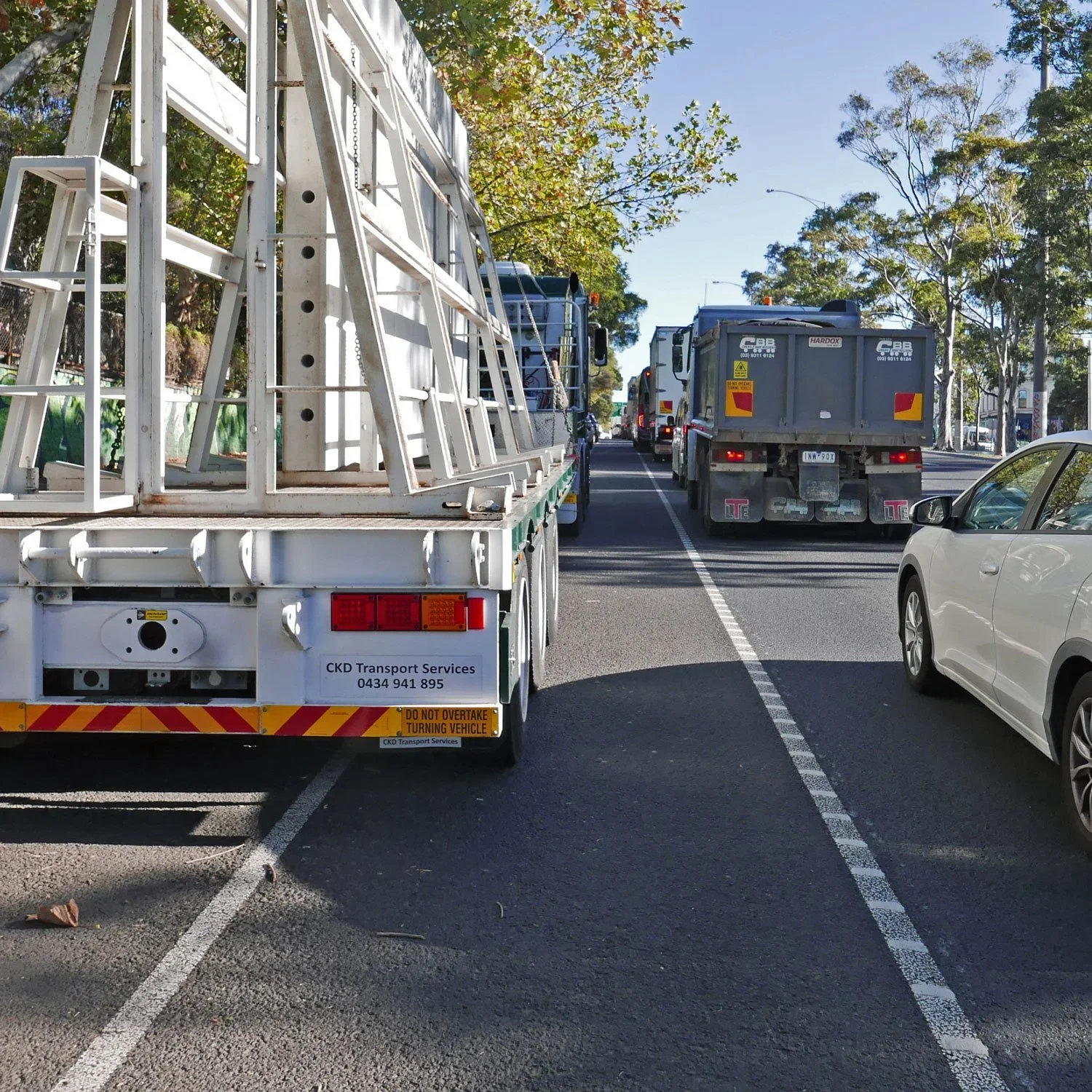
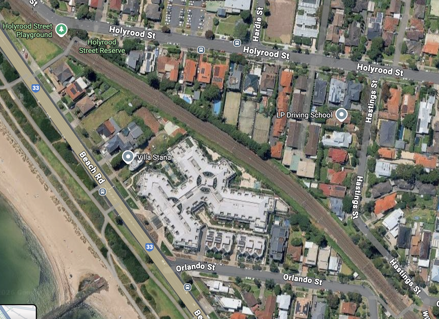
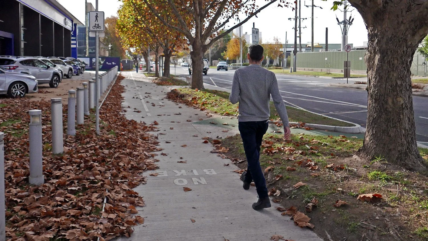
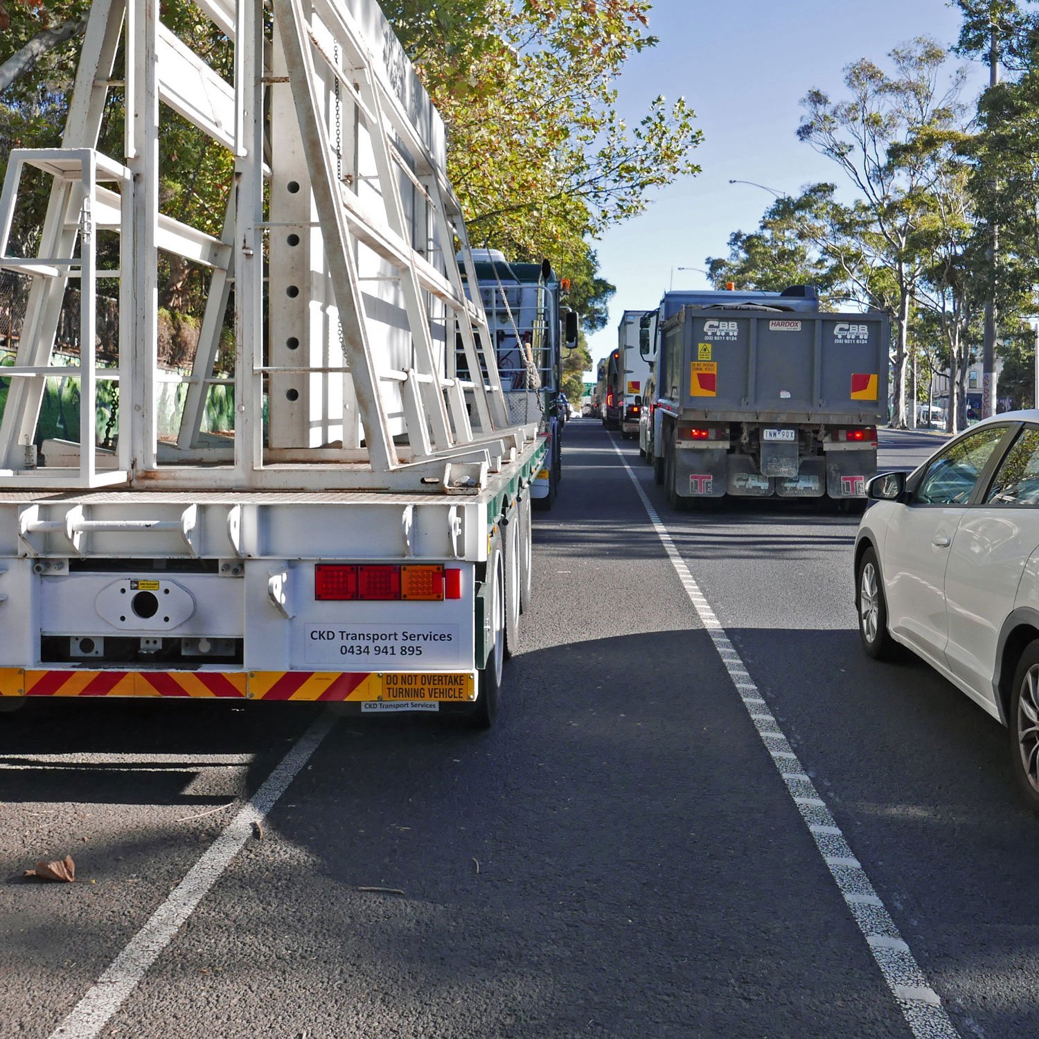
This ban will impact commuters. Many users of Victoria’s public transport system utilise e-Bikes for the ‘last mile’ part of their journey (from station to home, or station to work). Often in a hurry, and often a lot further than a ‘mile’, an e-Bike is a very practical solution.

But an expensive e-Bike is not something that you want to leave locked at a station, or even at the haphazard secure bike parking (if available). So users take their e-Bike with them on the train, especially if they use it at both ends of their journey. And often, without this option, using public transport is no longer feasible, so it will be back to contributing to traffic congestion for these Victorians.

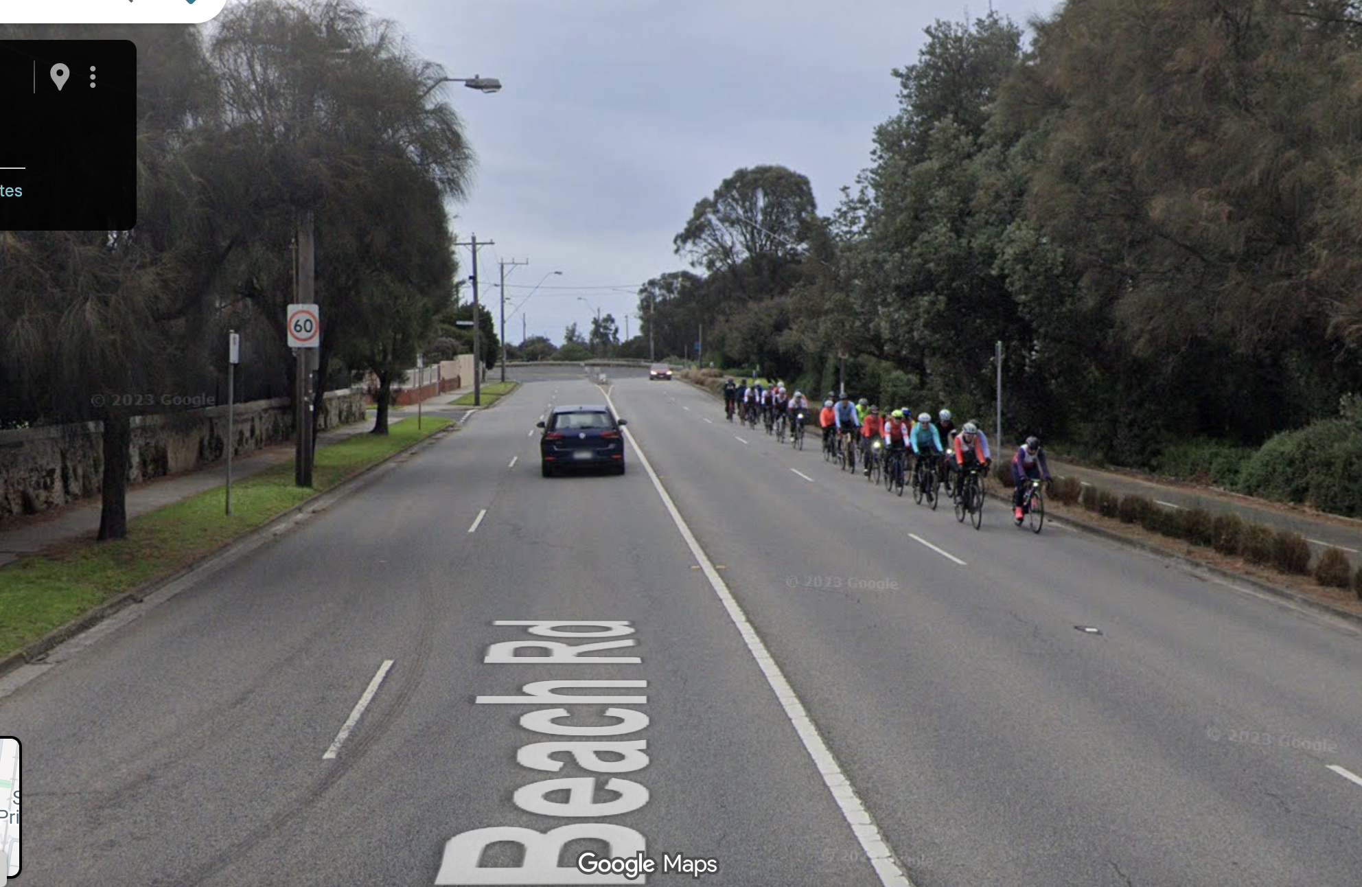
This ban will impact recreational and touring bike riders who use trains to get to trails around Melbourne and regional Victoria. Victoria’s recently capped fare regime has seen an increase in V-line patronage, and the bicycle bays of Vline trains are often full these days.

Cross-country e-Bikes have become very popular, enabling riders to take on hilly routes and windy conditions with ease. e-MTBs are all now very popular for riders to utilise on the increasing number of MTB parks established around regional Victoria. All of which has resulted in increased tourism (and revenue). But not everyone wants, needs or can drive there when Victoria’s transport system provides an excellent alternative.

This ban will affect food delivery riders (and their customers). Many food delivery riders live far from the suburbs that they work in. They need to take their e-Bikes on a train to get there. By banning all e-bikes, there is no incentive for riders to upgrade their bikes to a compliant model— indeed, if one needs to travel 20km before and after a shift, the more powerful (and currently illegal) models become more attractive.

And it is not just the delivery of food impacted. Train transportation is often utilised by other e-Bike delivery riders, and oftentimes Australia Post staff. This ban will result in the reduction of a lot of the convenient services that Victorians have come to rely on, especially since the boom in Work-from-Home arrangements.

This ban will affect parents who have taken up the e-cargo bike acquisition programs offered by a number of Melbourne’s councils. An e-cargo bike is a wonderful way for parents to take their kids to school and reduce school drop off congestion. But many parents have kids at schools that are a distance away, or there is an obstacle or hazard between home and school. So they take the train a few stops.

This ban will affect seniors and people for whom owning or renting an e-Bike has made an active lifestyle possible. They can still use their e-Bikes locally, but often these Victorians engage in activities with friends or groups like U3A for seniors, who do excursions utilising the train: connecting, staying active, building community.

This ban will unfairly affect people who do not own a car. Many people have chosen to give up on car ownership - due to economic circumstance - or simply by making logical and environmental decisions. There is also increasing pressure on older drivers to surrender their licenses due to decline of ability. 

Victorians’ decisions to get off the road are based on alternative transport services available to them in the area that they have invested to live. And this often includes access to an e-micromobility vehicle. 

To arbitrarily remove public transport services from these Victorians is unfair, and does not support sustainable lifestyle choices in our rapidly growing city.

Department of Transport and Planning have posited that they are basing these proposed changes on incidents and regulation examples in other jurisdictions. But what happened, and how different was the response there to what is proposed here?

Three serious incidents occurred involving the combustion of e-Scooter batteries on the London Underground in November 2021, the Madrid Underground and a Barcelona local train, both in November 2022.

As a result, a number of European transit authorities have since banned e-Scooters from carriage on public transport systems, including Hamburg (August 2023), Düsseldorf (March 2024), Munich (April 2024), Berlin (May 2024), Barcelona and all of Ireland (both October 2024). 

Each of these jurisdictions have cited the London/Madrid/Barcelona eScooter incidents of 2021-22, and all have specifically excluded e-Bikes and Mobility scooters from these bans.

In New York, it is only the Port Authority Trans-Hudson trains to New Jersey that have banned e-Bikes. New York City, with its huge MTA Subway and Commuter Train network, chose instead to implement regulations focused on restricting uncertified lithium-ion batteries.

As of 31 March 2025, Transport for London has banned e-Scooters, but also included a ban on all non-folding e-Bikes from their transport system. 

Mayor of London, Sadiq Khan, made it clear that the exclusion of folding e-Bikes from this ban is because TfL believe that it is not possible to customise or convert folding Bikes using the imported kits responsible for the “small number of e-Bike incidents” that have occurred on their system. 

Evidently London’s ban is about their authorities’ perceived inability to discern converted e-Bikes from the safer, commercial and compliant variety. 

Like the proposed Victorian ban, this is an issue with policing methodology that has resulted in punishing law abiding citizens.

It is important to recognise the criticality of a fire on a major metropolitan transport system. But whilst London have been dealing with a number of fires caused by non-compliant e-Bikes on their system, Victoria has had one reported incident. 

There have been far more reported incidents on Victorian Public Transport of combusting batteries in mobile phones and charging packs than those involving e-Bikes. And yet these other risks are not being banned.

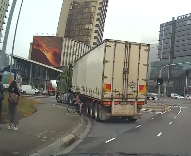
That one local e-Bike incident was a customised eBike that caught fire on board a Belgrave bound train at the above ground Union Station on March 15, 2025. The bike itself was a Fluid MTB converted with an imported hub drive motor and accompanying battery pack attached to the frame. It is apparent that the e-Bike conversion kit is to blame. 

These conversion kits - that can easily be ordered online - often include motors with a power rating that makes them illegal to use as an e-Bike in Victoria. Often these kits include a throttle which renders them no longer a ‘pedelec’ (or pedal initiated drive). The control systems can also be easily overridden to remove speed limiting. Sometimes these kits or completed bikes are purchased from a different state with different regulations.

The batteries that come with them are often unbranded; have rudimentary battery controllers without conditioning modes; and they do not comply with Australian standards. These batteries often fail because of the haphazard welding connecting the internal lithium ion battery components. They can fail when being charged without an appropriate control mechanism, or even when they receive a prior blow that breaks and shorts one of the internal welds.

Whilst the illegal motors are a danger on roads and trails, causing deaths and injuries that have been the subject of Victorian Coroners inquests, it is the batteries that are the cause of any runaway combustion on our transport systems and elsewhere. And it is the batteries that are what needs to be central to this particular regulatory process.

One such inquest by Victorian Coroner Audrey Jamieson, on 18 July 2025 reported a finding on the death of one e-Bike rider following a collision with another. Her honour identifies the issues around authorities identifying which bikes are non-compliant, and recommends that Victoria Police gain methods for better detection.

The Coroner opens the door to a 'radical' blanket e-Bike registration regime, but only as a ‘possible outcome’ from her honour's proposed intra-governmental conference on illegal e-Bike detection. And despite some errant reporting around the findings, her honour does not make e-Bike registration a clear and formal recommendation.

As a suggested alternative to a broad ban, Victoria could restrict only non-commercial (or kit) e-bikes from public transport. This could be achievable by allowing only e-bikes with batteries manufactured by a list of prescribed makers, batteries certified to meet Australian standards (UL 2271), aboard trains.

New York City’s response is along the same line: targeting the actual cause of a problem, but at the point of sale.

Whilst Victoria is not responsible for importation controls, it is responsible for consumer protection at the point of sale. Deflecting to the Federal Government, or blaming differing state laws, is not a responsible course of action. 

Both NSW and Victoria have called on the Federal Government to restrict importation of the dangerous e-Bike kits and uncertified batteries.

New South Wales are not waiting for the Federal Government, or unified national regulations. Despite the NSW State Government currently considering a “temporary” e-Bike ban on public transport, unlike Victoria, they have already commenced statutory processes to regulate the cause.

As of February 2026, NSW’s Department of Fair Trading requires that all e-Bikes and their lithium-ion batteries are tested, certified and marked prior to sale in that state, with penalties of up to $825,000. These devices are now ‘declared electrical articles’ under the NSW Gas and Electricity (Consumer Safety) Act 2017.

The enforcement of this reclassification was pushed back from August 2025 whilst working with the local industry to ensure that compliance and testing methods are achievable. NSW Transport Minister John Graham has stated that any train ban would be temporary until these sales restrictions are in place and working.

Victoria does not really need to reinvent the wheel to find a working model. Restriction and certification at point-of-sale isn’t a catchall solution, but it does give Police the ability to clearly identify illegal e-Bikes and batteries - exactly what the Victorian Coroner and others have called for.

If a product certification process and its enforcement is too hard for the Victorian Government, another simple - even temporary - alternative is requiring e-bikes to have their battery removed when carried on public transport.

In this scenario, if something does occur, it is a lot easier to remove a battery from a train, than an aflame e-Bike. There could also be the additional safety option to seal the battery in a sturdy, airtight bag - removing oxygen from any potential fire equation.

There are other alternatives that could be explored that do not involve the blunt instrument of a broad ban. 

Whilst the Victorian Department of Transport and Planning are content to bolster the cause for a ban by looking at incidents in other jurisdictions, they have limited their outlook for examples of constructive solutions. 

Look to Europe to see examples of restraint in what is banned. And other jurisdictions such as New York City for positive ways to target the actual problem.

This is not just an opportunity to take action on the issues associated with some e-Bikes on trains. This could be the impetus for a solution to the same issues that can and do occur anywhere across the Victorian community.

Newly revealed plans show Council and State govt blocked a beautiful boulevard on Kerferd Rd with safe green transport links

Bike Melbourne and the Port Phillip Bicycle Users Group have received plans for the Shrine to Sea proposal, under an FOI application.

Aerial photo of a boulevard with wide grassy median, with city skyline in background

Kerferd Rd is one of the City of Port Phillip’s planned network of safe cycle routes.   It links Anzac Station, and the protected bike lanes on St Kilda Rd, with the beach and the Bay Trail.  It runs past several schools, the Moray St bike lanes, MSAC and Albert Park.   Kerferd Rd has one of the highest crash rates for Council-controlled roads. 

The documents show that the planned protected bike lane delivered the on the priorities set by the community. Councillors scuttled the state government funded project in 2023 without substantive justification. The community has missed out on the investment, the improved landscaping, and the safety benefits to all users.

An infographic showing number and location of crashes on Kerferd Rd

Shrine to Sea history

The original Shrine to Sea plan was to improve the boulevard that runs from the Shrine of Remembrance, along Albert Rd past Albert Park, and then down Kerferd Rd to the beach.   

A diverse community panel met extensively online during the pandemic to discuss the priorities for the community, the opportunities and constraints. The community panel’s recommendations are here.   Among the recommendations:  Bike lanes to be interconnected for the entire length of the boulevard (LC01) and Use landscaping to define a separate bike pathway on Kerferd Road to isolate bikes from cars (LC08).    In Nov 2021, DELWP mostly supported these recommendations, though they noted that in places shared paths would be used instead of dedicated on-road lanes.   

A streetscape, showing a grassy median with trees, traffic lane, parking lane with silver car, planting with flowers, bike lane crossed by a pedestrian crossing, nature strip, footpath.  There is a person crossing with a pram.

The protected bike lane would also improve connections to the car parking, and include extra planting.

Despite this initial positive assessment, pressure by councillors led to the State government dropping the protected bike lane aspect of the project. In 2023 the State Government “decided that further targeted engagement is required for a safer active transport solution along Kerferd Road. For this reason, the protected bike lane is being separated from the Shrine to Sea masterplan to be considered at a future time”.  

Decision making 

There were community campaigns both for and against the separated bike lane.   Opponents of the separated bike lane shared a lot of misinformation, including about bin collection, parking capacity, and safety that could have been easily resolved.  It’s disappointing that those with access to the full reports did not use this information to inform the community.    We are sharing the results of the FOI to partially remedy this.

The decision to shelve the bike lanes (or “separate them from the project”) was made by State Government in May 2023 behind closed doors, under pressure from Port Phillip councillors. Port Phillip council is responsible for Kerferd Rd, and may have spooked their funding partner for any future improvements. 

At a meeting in August 2023, Council failed to support the protected bike lane aspects of the plan, and instead asked the Victorian government for support for generally ineffective measures to address crashes such as “white line-marking, green treatments at conflict points and additional regulatory signage”.  

What the documents show

There was extensive investigation of 5 design scenarios:  the current situation; a buffered bike lane; a bike lane on the median;  the protected bike lane; and a service-road bike lane (north section only). 

Each design was assessed using the Healthy Streets Design Check Tool for Australia; and through the Shrine to Sea Metric Criteria assessment which was developed in response to local resident and community feedback, policy alignment and operational needs of DEECA and CoPP.  

Under the Healthy Streets assessment tool, the protected bike lane scored highest (or equal highest between Richardson and Danks St).   The protected bike lane also scored highest under the Shrine to Sea metric criteria. 

Table showing how the different scenarios rated on the healthy streets and S2S metrics.  The protected bike lane ranks first.
Table showing how the different scenarios rate under healthy streets and S2S metrics.  Protected bike lane ranks first.

The protected bike lane scenario:

  • would preserve access to properties for people using cars, keep almost all car parks and improve access to car parks by extra crossings of the wide drain

  • be suitable for use by all micromobility modes, including scooters, trikes; and all users including kids and the elderly

  • leave sufficient capacity for vehicle traffic, with intersection modelling assessment showing that the proposed cycle infrastructure can be accommodated within the existing network without any major deterioration in intersection performance at two of the three sites evaluated. At the Ferrars/Canterbury intersection, there would be an average extra delay of 28 seconds for vehicles during the AM peak. 

  • Allow construction of safe pedestrian access to the central median

  • Include new plantings curbside

Rendering of the protected bike lane plan, showing extensive planting

Projected benefits of the protected bike lane include:

  • Increased ability of kids to ride to school, sport and around their community

  • Better cycle access to destinations like MSAC, the South Melbourne Market, Anzac Station, and the beach, leaving more car parking available for those who drive

  • Discourage hooning on Kerferd Rd through road redesign for slower speeds


Specific concerns addressed


These are concerns that were raised at the August 2023 council meeting. 

“The bike path surface will be sloped which will make it dangerous for people on trikes.”   Concept plans show a standard, flat bike lane surface, of similar width and cross-section to lanes on St Kilda Rd. This would be useable by people on bikes, scooters, mobility scooters, and trikes.

“There was no co-design process.”  The community panel went through a process informed by subject matter experts on design principles, landscaping, and accessibility.    

“This will displace vehicle traffic on to neighbourhood streets”.  This wasn’t modelled specifically (at least in the documents that were released) but there is no evidence for this available.

“One lane is not sufficient for an arterial road.” Kerferd Rd is not an arterial road.   Capacity is generally limited by intersection capacity rather than number of lanes, and modelling of intersection effects showed minimal impacts at 2 of the 3 intersections studied, and a 28 second delay during morning peak at the Ferrars/Canterbury intersection. 

“This will make it hard to access car parking”.   This was specifically studied.    In the current set-up, “pedestrians must traverse a turf nature strip, non-mountable concrete kerb and bluestone spoon drain, which in some locations is very steep and deep”.   With the  protected bike lane,   “access to the parking spaces will be enhanced by new raised crossing points that remove the existing difficulties that people with mobility issues face today due to the lack of connections to footpaths, navigating high kerbs, and having to cross steep sections of uneven bluestone paving”, a clear improvement on current conditions.

Regarding overall number of parking places:   the protected bike lane has a reduction in parking places of 14%.   According to the released documents, “The design retains sufficient car parking to cater for the demand of users based on occupancy surveys completed in Nov/Dec 2022”.  The average occupancy rate of car parks along Kerferd Rd was 59%, and it is demonstrated that “that in most sections along Kerferd Road, even when occupancy is at its highest, there is a surplus of available car bays”.

Documents referenced:

Plans received from the  FOI, including:

  Concept plans for the protected bike lane

Detailed comparison of five different scenarios

Recommendations of the community panel

City of Port Phillip Integrated Transport Strategy.


Images in this post come from Design Scenarios and Assessment for Shrine to Sea cycling corridor— Kerferd Rd.

Councillors Ride, Fishermans Bend and Port Melbourne, May 2025

On Friday 30th May PPBUG took City of Port Phillip councillors Heather Cunsolo and Justin Halliday for a bike ride around Port Melbourne and Fishermans Bend.

Cr Halliday, Cr Cunsolo, Julie, Simon, Geoff from Back2Bikes workshop

Fishermans Bend is a suburb in transition— currently industrial, the plan is for employment areas (north of the freeway) and residential (south of the freeway). The challenge is to ensure that the infrastructure for the future uses is in place. A recent Port Places post discussed how this issue was addressed in Port Melbourne 20 years ago.

“If Council wanted people to walk, it had to be safer, especially for children.

Parents with children at kindergarten in Port Melbourne and primary school in Albert Park ran the gauntlet of the Pickles x Liardet and Richardson St intersection daily. In 2005, traffic lights were installed ahead of Becton’s The Park development…. This came about through the patient and tenacious advocacy of council officer Meg Selman to an extremely reluctant VicRoads.”

And in Fishermans Bend:

“Investing in walking will stitch the established residential areas of Port Melbourne to the new residential areas of Fishermans Bend. Communities will grow around the primary school…The gold standard will be when children can make their way independently to school with their parents having confidence that the routes they take are safe. At this stage it seems impossible….But so it did on Pickles St 20 years ago.

City of Port Phillip’s Integrated Transport Strategy 2018—2028 - “Bike riding network improvements” plan for Fishermans Bend and Port Melbourne.

The Victorian Government’s Fishermans Bend Strategic Framework - Cycling Infrastructure Plan

Our route

Points of note on the tour.

Our starting point, the Garden City bike route is one of the few completed Integrated Transport Strategy routes. It’s a shared path, which is no longer considered best practice for well-used commuter routes. There has been some conflict about use of the shared path section. 

Garden City route crossing.

Next, Williamstown Road. Poor amenity for cyclists, with a high level of traffic and unprotected, painted lanes in the door zone. There are two planned crossings — one at Smith Street, near the new primary school; and one at Beacon Road, near the new Fishermans Bend High School and JL Murphy Reserve. But more on that later in the tour.

This is the site for one of the planned crossings of Williamstown Road. On the south side it connects to Leith Crescent and Howe Parade. On the north side is Smith Street and the new Fishermans Bend Primary School under construction. 

Smith St and streetscape outside Fishermens Bend Primary School. This is marked on the ITS as an off-road shared corridor. It connects to the planned crossing of Williamstown Rd to the south, and the planned Strategic Cycling Corridor on Plummer St to the north. Currently carries over 2000 vehicles and 95 trucks daily. Council’s original proposal to modify this to a one-way street ahead of the primary school opening was recently rejected by Council. 

As one councillor pointed out, under the (oddly unconsulted) new option that passed 6-3 at council last month, instead of the previously planned one-way Smith Street version, the median strip (shown) on Williamstown Road is to be closed instead, to prevent half of the heavy traffic from Williamstown Road turning (hastily) into a Primary School precinct. This new option also proposes that these trucks are to be curfewed, but only during school pickup and dropoff times. Yet no one is clear about who will enforce that, and how.

 Smith Street, whilst wide, currently has no footpaths at all, and the nature strip is being annexed by legacy businesses with outdoor seating and a food vendor. The street is a constant two-way flow of large trucks, with commercial vehicles dominating the parking places.

Plummer St has no on-road cycle lanes, but presents wide nature strips for possible off-road shared paths. This is something that an earnest council could consider as a way to tick a planning box, draw on State funding and Developer Contribution Fund revenue, and maybe also save lives. As the road is a State responsibility, currently Council claims no mandated role to fix the situation. But they do have one as an advocate to State, a partner in Fisherman Bend urban renewal, and they also have planning powers.

Plummer St is a Strategic Cycling Corridor (East-West), but certainly isn’t safe. It is also a designated “truck by-pass” upgraded by Vicroads to try to move Webb Dock bound trucks off Williamstown Road. It is also the site of a recent cycling tragedy. 

Next, Salmon Street and the Salmon Street Bridge. Salmon Street is a Strategic Cycling Corridor (North-South). The ITS shows many planned active transport crossings of the freeway, connecting the future residential and employment centres of Fishermans Bend. These are Todd Rd, street west of Salmon St, Salmon St (connecting to Smith St), Douglas St, Graham St, Ingles St. With the exception of Todd St, these are non-existent or highly dangerous. Currently conditions on Salmon St are extremely inhospitable for people on bikes.

Salmon St bridge has a dangerous grate halfway down the road.    The only alternative is a very narrow footpath on the north side (left side of left photo), only accessible by narrow steps.      

One Active Transport solution floating about is to install a shared path cantilevered from the side of the bridge, as had been done in many other localities around the world. Council, through its very ambitious Integrated Transport Strategy, has suggested building a lot of new shared path bridges over the M1. Here is one project that already has the supporting structure in place.

The Salmon Street Bridge from the City of Melbourne side. Note that City of Melbourne have installed bike lanes - both on and off-road - following the Strategic Cycling Corridor. But they abruptly end at the bridge and the municipal boundary. Call it the Vegemite gateway to Port Phillip.

 Next on the tour, we’ll have look at what the City of Melbourne are doing about getting on with the job of building the better infrastructure needed for a new Fishermans Bend. 

Salmon Street off-road shared path (City of Melbourne) approaching the Skills Precinct. The Fishermans Bend Skills Precinct (University of Melbourne campus under construction) where Salmon Street meets the new Turner Street off-road shared path (City of Melbourne).

The Fishermans Bend Urban renewal precinct is split by the municipal boundary, being the M1 Freeway, with only limited crossing points. Both councils have an important job to do in making plans a reality, connect communities, or they could end up with an unlivable mess of people living in isolated developments with deadly roads and no green space. 

It also seems that each council is going at a different speed.

Turner Street.  A City of Melb project—- a reasonable bidirectional path, made of permeable paving, which deals fairly well with many driveway crossovers.

All driveway crossovers on the new City of Melbourne Turner Street off-road shared path feature rumble strips for cyclists, and speed bumps and signage for vehicles. The landscaping screens out the road to improve the visual experience, and includes seats and tables. It will improve as the trees grow, which is good planning vision.

The Turner Street off-road shared path ends under the Bolte Bridge, where the off-road path turns north towards the river, crosses Lorimer Street and connects with the South Wharf promenade, the CBD and on to the Yarra River trail.

The next “Gateway to Port Phillip” that we investigated is the Ingles Street Bridge. Like the Salmon Street one, it’s a narrow and dangerous crossing for people on bikes, though at least there is access to a footpath on one side.

View from the top of the Ingles Street Bridge over the M1 to Southbank and the CBD. Both the Salmon Street and Ingles Street Bridges have great views, which support ideas that have been floated of creating a highline type project, removing a traffic lane to create a wide landscaped promenade, encouraging people to visit and recreate. Now that could be a great ‘Gateway to Port Phillip’.

This is the Montague Street gateway to Port Phillip: a series of pedestrian crossings under the M1 and crossing the multiple Freeway off-ramps located here. The crossing timings are short, the safety islands are small, and the traffic coming off the freeway is moving heavy and fast. There have been deaths and injuries here when pedestrians and cyclists have been caught short, or rushing drivers blow through red lights.

South Wharf Car Park Connector Path:   a poorly signposted back route around the South Wharf building. 

Once upon a time there was a more direct and scenic route from Pollywoodside to the Sandridge Trail, between Jeff’s Shed and the Convention Centre. When South Wharf was extended the bike route connection became an annoying afterthought to the developers. 

The resulting maze of a route arbitrarily weaves its way around parked cars and freeway pylons. The lighting is poor, which discourages many at night. And the signage is faded or non-existent. If you find yourself lost trying to find your way through here you are not alone. Many people can’t even find where it starts for lack of signage. 

It would be great if the shopping centre operator cared to improve and maintain this route, especially as it is on leased public land. Yet another gateway to Port Phillip that needs attention.

The Melbourne end of the busy Sandridge Trail at Southbank Tram Depot. Wayfinding signage is lacking, relying on prior route knowledge rather than highlighting a transport gateway.

During a previous councillor ride in this ward, PPBUG raised community concerns about the chicanes on the tram track crossovers at either end of the Depot, advocating for wider placement to allow a smoother and easier flow of bikes and pedestrian traffic. It’s good to see the new ones in action - just watch out for the trams!

The shared path along Normanby Road, here at the edge of Port Phillip, is quite rooted by trees: bumpy with a blind corner around a pylon to add to the adventure. It needs an upgrade. 

[IMAGE BELOW] You notice when the path crosses the municipal boundary, City of Melbourne’s side is newer, wider, more solid and flat.

This part of the Port Phillip - City of Melbourne boundary also has crossovers at Southbank Depot Tram Stop with access to South Melbourne Primary School, the new Kirrup Park precinct and Ferrars Street; and further down the path is the Whiteman Street gateway (pictured) to the popular Cecil Street bike path through South Melbourne and beyond.

Shared paths give a wide range of transport options, including to mobility scooter users pictured here under the freeway.

Back to Bikes on Williamstown Road in council owned premises that they are required to soon vacate.

Geoff from B2B accompanied our ride and updated us on the search for a new workshop for this amazing community group. Councillors on the ride assured us of their efforts to help find a new home. Check out Back2bikes workshop.

Next on the tour, the scene of the crime: Bridge Street, Port Melbourne. This was one of the Port Phillip streets chosen for the State Government’s Pop-Up-Bike-Lane projects a few years ago. It was also the subject of some vitriol and rage from a few in the community and in the wider culture wars. As a result, many of these temporary bike lanes became past tense. 

Bridge Rd/Williamstown Rd

One bit of infrastructure to disappear was this safety lane here at the corner of Bridge Street and Williamstown Road. The now-gone curb blocks stopped cars from running over bike riders as the cars turned left, craning their heads to see oncoming traffic from the right. Nowadays it is a brave bike rider that risks riding into that space.

The new Fishermans Bend High School, on the corner of Plummer Avenue and Graham Street. It’s a very important piece of State Government infrastructure for the community in this urban renewal precinct. 

And they have installed some bike hoops as part of the build. Perhaps for decoration as there are no bike paths leading to this school. There are no curb cuts for exiting the traffic on dangerous Plummer Avenue. There are not even pedestrian crossings on both corners of the school (as shown).

It seems that a lot of students cut across JL Murphy Reserve to access the school. There are tracks, but no connected bike paths. And then we get to Williamstown Road on the other side of the Reserve, and there is not even a footpath along the road. 

It is like the High School dropped from the sky and council doesn’t quite know how to connect it to the rest of the community. There is great opportunity for Council to be a hero here. JL Murphy Reserve does not have to be just about sports fields, there is space between the fields.

[IMAGE BELOW] At Williamstown Road there is a plan to install a pedestrian crossing (mentioned earlier) right here. It will connect JL Murphy Reserve to Beacon Road in Garden City, and on that will be one day the new Federally funded bike path-lette. Currently, students by the score just dash across four lanes of heavy traffic (as shown below) before and after school. 

Site of planned crossing, Williamstown Rd.

We cross the road ourselves and here we have - at the end of our tour - the aforementioned Beacon Road. The Beacon Road Bike Path was one of many Active Transport projects announced for funding by the Federal Government’s Department of infrastructure just before the recent Federal Election. The $515,000 (or $550,000 depending on who is telling it) is for a 320m stretch of protected bike lane that will run from Williamstown Road (and the new pedestrian crossing that will be one day installed) and connect to the Beacon Cove Bike Path. When it eventually happens it will be a very welcome connector conduit in our city’s Active Transport network.

The Beacon Road Bike Path is just one of many parts of the network. Every part of a network is important.

Some have said that small sections of bike path are not worth the tax dollars, the rates, the lengthy consultation process, the push back from legacy businesses (and their lobbyists), nor the political juice required. “A bike path from nowhere to nowhere” said one council voice on a small shared path project recently contested (Smith St). Every link is followed by another. And if they are all eventually joined up, and the plan is completed, then communities get connected, and people can live better. 

Thanks Councillors for your time and willingness to listen! We will be repeating this ride with some of the other Councillors in a few weeks time.

Relevant planning documents and other links:

Move Connect Live: City of Port Phillip’s Integrated Transport Strategy 2018—2028

Fishermans Bend Framework

Strategic Cycling Corridors in Victoria.

Walking in Port Melbourne and Fishermans Bend A blog post by friend-of-PPBUG Janet Bolitho

Back2Bikes workshop

A safer, greener Fishermans Bend Primary Precinct... or keep on truckin'?

There is a proposal before council to upgrade the southern section of Smith St, Port Melbourne - between Tarver St and Williamstown Rd - where the new Fishermans Bend Primary School will open in 2026 and a Kindergarten in 2027.

Option 1, the original plan sent out to community consultation in 2024, is to create a reduced speed, one-way street where traffic enters from the north end, and then only turns left onto Williamstown Rd.

  • Option 1

  • prioritises kids and their families, with footpaths and bike lanes for kids arriving on foot, scooter and bike

  • reduces school traffic by making alternatives more attractive

  • Has parking for school drop-offs 

  • is a one-way street allowing access for adjacent businesses, but discourages trucks and through traffic 

However without further consultation, a new option (Option 2) is being presented to Council this Wednesday (7th May) as the preferred option. Option 2

  • Removes the bike path and footpaths from the western side of Smith St

  • Prioritises use of the street by trucks and two-way through traffic, with a limited truck ban only between 8.00-9.30am and 2.30-4.00pm.   Currently 95 trucks and 2200 vehicles per day use Smith St.

What was in the original plan (OPtion 1)?

There is provision for a safe drop-off and pick-up space in a new ‘children’s education precinct’.

map showing the Option 1 layout

Safe easy access to the school & kindergarten

The new safer green space that is created as a result of reducing car and truck traffic lanes (to one-way only) and upgrading the footpaths will include a linear park for more play area, and safe, easy access for students with new trees, increased lighting and a protected active transport pathway.

Safer from traffic.

This upgrade will rein in the amount and speed of traffic by minimising the number of trucks taking shortcuts, and preventing all vehicles from racing across busy Williamstown Road as they turn right.

When a new signalised pedestrian crossing across Williamstown Rd is added, the precinct will safely connect pedestrians and cyclists to Garden City, the Bay Trail and beyond.

Walking, riding or scootering to school will be an easier, safer and more pleasant experience for local families.

Fishermans Bend is slowly developing from industrial decay into residential infrastructure and housing for families. But most of the dwellings are apartments without gardens and play space.

So positive changes to local pockets like this are vital to creating safer streets and parks for children and adults alike.

Connecting communities, reducing congestion.

As these living pockets of Fishermans Bend develop, so too the networks of safe paths will connect together.

Eventually the active transport paths will enable the people who live and work in Port Phillip to walk, ride or scooter safely to the new employment and education precincts on the river side of Fishermans Bend, and further into the city.

Good city planning, and more parks.

City of Port Phillip is a municipality with some of the highest population density in the state, and that is only increasing. But in response, council has a good track record of reclaiming roadways and former wasteland and turning them into friendly, safe space for families.

Great examples include Mitford St / Poets Gve at Elwood Primary, Moubray St Community Park at Albert Park Primary, Lemnos Square at Albert Park College and Kirrip Park at South Melbourne Primary. And there’s a trial pocket park at St Kilda Primary.

Many of these places have become cherished parks that everyone in the community can enjoy outside school times.

what is in option 2?

In Option 2, the footpaths and bikepath on the west side of the road are removed— or rather, shifted to “stage 2” which will be in the “long term”. There is no schedule when this will happen… but the school is opening in 2026. Kids need attractive safe streets adjacent to their schools from day one, not in the never-never.

Trucks and through traffic will have easy access to Smith St. A limited truck ban between 8am-9:30am and 2:30pm-4pm is mooted, but it’s not clear how this will be enforced— and in any case, kids and families will be using the street throughout the day. Currently 2200 vehicles and 95 trucks on average use Smith St daily.

Two-way traffic and 40km/hr speeds. This is not a kid-friendly safe zone. The Australasian College of Road Safety says that “the risk of fatality for a pedestrian hit by a vehicle travelling at 30km/h is around 10%, compared to approximately 40% at 40km/h”. Moreover, it’s more effective to communicate the expected speed through the design of the road, than posted speed limits alone.

Why has this happened?

Legacy businesses have lobbied to maintain their truck and vehicle access to Smith St, at the expense of the future school kids. While it’s important that access is provided for the existing businesses, the priority should be on the future and enabling a transition to a sustainable, child-centred education precinct, where the necessary infrastructure is in place from day one. Visitor access to these businesses does not require two-way traffic— visitors parking on Smith St can access from the north, while there is alternative on-street parking on both Williamstown and Tarver Streets.

could we be more ambitious?

While Option 1 represents best practice for our LGA, we could be going further.

In Paris, hundreds of schools have school streets, where the streets immediately in front of the school have been closed to vehicles, but opened to kids walking, cycling and scootering. 

Streetfilms have made short Youtube video describing the phenomenon of Paris School Streets.   

Could the south end of Smith St be completely closed to through traffic, allowing extra circulation and green space for the school kids and neighbours?  This would require negotiation with the legacy businesses who have entrances on Smith St, and also thought given to safe places for a drop-off zone.   

Another option is to plan a transition to a full closure in coming years as the neighbourhood character changes from warehouses to residential/businesses.

Councillors ride March 2025: East St Kilda, Balaclava, Ripponlea, Elwood

On Tuesday the BUG took new councillors Libby Buckingham and Justin Halliday for a ride around their wards and surrounding suburbs.

From left: Julie (PPBUG); Cr Justin Halliday; Mya (PPBUG); Cr Libby Buckingham; Pierre (PPBUG and Back2bikes volunteer).

The route over St Kilda Hill is dangerous, with heavy trucks using the left-most lane alongside cyclists with only a line of paint separating the two. A door zone adds extra hazard. This is a State responsibility, but would benefit from Council support.

Over St Kilda Hill, cyclists are expected to ride alongside heavy traffic.

We also visited some excellent cycle infrastructure. Since the construction of these protected lanes on St Kilda Rd, rider numbers have increased by 200-300%.

However south of Wellington St, the protected lane ends and only a door-zone lane is provided.

We then went along Wellington St, a shimmy route— which means a bicycle route with little dedicated infrastructure, but some traffic calming and bike symbols painted on the road (sharrows).

Once in Alma Park, we rode one of the few off-road bicycle paths alongside the railway line. This is part of the proposed Green Line route.

We made our way down to Ripponlea along Williams St. At Ripponlea we discussed the possibility of reducing the speed limit to 30km/hr, as this is a high-pedestrian area, as well as a state Strategic Cycling Corridor. The only provision for cycling here is a narrow, door-zone lane. The lane also narrows rapidly after the railway crossing, creating another hazard.

We headed over to Elwood. Here we looked at the location for the long-promised signalised crossing of Glen Huntly Rd. We also looked at the road treatments at the Primary School, which includes a one-way road with drop-off zone on Poet’s Grove, and the closing of Mitford St (which has been incorporated into the primary school grounds). These are good models for the new primary school at Fishermans Bend.

Then up to Dickens St, where there is a very unsatisfactory crossing of Brighton Rd, to connect to the Primary School. Outside the primary school a new pocket park has been created, with space for kids to play and a well-used basketball hoop.

Thanks Crs Buckingham and Halliday! We wish you well in your term on Council.

Photo credit: Simon Kosmer.

St Kilda Rd separated lanes, Junction to Carlisle: lobbying our local MPs

This January, we’ve been talking our local MPs, Nina Taylor (MP for Albert Park) and Ryan Batchelor (upper house MP for Southern Metropolitan Region.

3 women and a man standing inside.  There is a cartoon of a person on a bike overlaid.

Nina Taylor (left) with Dan, Lorelle and Julie from PPBUG.

Both of them listened to our concerns about the immediate safety risks posed by the unprotected, door-zone lane in close proximity to heavy trucks; and about the need for a plan to make all the strategic cycling corridors fit for purpose.

Neither made any commitment to improve the situation or had any news that planning to fix these problems was underway.

Our meeting with Ryan Batchelor was in conjunction with our campaign partners Stonnington BUG and Bike Melbourne.

More about the campaign here.

How to contact the City of Port Phillip councillors

To fix a small issue like a pot hole or missing curb ramp, the fastest way is the use the app Snap Send Solve. If the issue isn’t resolved quickly, email portphillipbug@gmail.com and we’ll follow up at our regular meetings with Council officers.

But sometimes we need a BIG ISSUE fixed: we need a safe route to school, or a protected bike lane. Time to email our councillors!

St Kilda Road separated lanes update, Junction to Carlisle St section

The St Kilda Rd separated bike lanes project was originally announced to run from the City to Carlisle St, but during construction it was down-graded to stop at St Kilda junction. Earlier this year we found out from the office of Active Transport minister Gabrielle Williams that the project contractors have closed up their office, without passing on the design work on the remaining section.

The route over St Kilda hill is fraught with danger.   Heading north, people on bikes have an unprotected on-road lane, with heavy trucks directly alongside-- heavy traffic from the Nepean Highway tends to turn off onto Queens Rd at the junction, so will be in the left-most lane.   Heading south, there is a "door zone" on-road, unprotected lane.      Cyclists travelling down the hill are travelling at speed, giving people opening car doors into the lane even less time to make a careful check.  

MLC Katherine Copsey has raised this in Parliament.

This route is one of the main (C1) Strategic Cycling Corridors, connecting the city with Frankston. The improvements on the northern section have increased the number of users there up to 300%— which is great, but also means that more people will be using the unsatisfactory southern sections for access.

We are asking our local MPs, Nina Taylor (Albert Park) and Ryan Batchelor (Southern Metropolitan) to make funding and building this section a priority—- before some is injured or worse.

Help out: email your MPs. If you have photos, videos or a story about your experience on this section, please share it with us portphillipbug@gmail.com to add to our campaign.

Strategic Cycling Corridors: when will these be fit for purpose?

In August 2024, a 27 year old Southbank man was killed in an (alleged) hit-run on Plummer St, Port Melbourne. He was working as a food delivery rider.

Every death is a tragedy for the family and loved ones. This one is particularly sour as Plummer St is one of the sparse network of roads designated as Strategic Cycling Corridors. Plummer St is partly 4 and partly 2 lane, very wide, and characterised by fast speeds and truck traffic.    

Map of strategic cycling corridors, shown in pink and blue. Plummer St highlighted in yellow.

Strategic cycling corridors in Port Phillip. Plummer St top left, highlighted in yellow.

According to State Government, “SCCs are the main routes of the bicycle network, similar to how arterials are the main routes of the road network. They identify the most important routes for cycling for transport that connect to key destinations of metropolitan and regional significance, including key employment areas, activity centres and railway stations.”

However, unlike arterials, the conditions of the SCCs are currently massively unfit for for purpose, and there is no plan for systemically upgrading the infrastructure. Some routes have been upgraded as a by-product of other projects such as the Level Crossing Removal Project (for example, there will be a separated route on Queens Avenue, Caulfield). The local flagship project of the St Kilda Rd bike lanes took over 20 years of lobbying, during which several people were killed. (And that project remains incomplete, with only painted lanes between the Junction and Carlisle St).

Here is a scary clip from Lorimer St (also a SCC).

Screenshot from the clip (the cyclist was not squashed thank goodness).

Given the lack of progress on infrastructure, it’s fair to ask whether these are nothing but lines on the map.

Following the death in August, Port Phillip BUG wrote to Road Safety Minister Melissa Horne, asking her to prevent future injuries and deaths—- including of delivery riders at work—- by upgrading the SCC routes.

In November, we received a response from Stuart Johns, Executive Director of Modal planning.

“Victoria has adopted the safe system approach to road safety, which recognises that we as humans are vulnerable and make mistakes that shouldn’t cost us our lives. ”

For people riding bicycles or using other micromobility devices, the practical application of this approach means that on-road facilities should be physically separated from motorised traffic in environments where traffic operates at speeds of more than 30km/h. Earlier this year, DTP adopted a policy outlining that any of its new or upgraded projects that occur on SCCs should include treatments to this effect.
— Stuart Johns, Department of Transport and Planning

“Bicycle facilities, typically off-road shared use paths, are also included as part of all major state transport projects (road and rail) and a combination of off-road shared use paths and exclusive off-road bike paths are being progressively delivered as land develops in our growth areas. The policy also requires turn controls at new and significantly upgraded signalised intersections which will further improve safety for cyclists.”

Link to the new policy.

This is a long way short of a funded, systematic program that would deliver suitable infrastructure on SCC routes within any defined timeline. However it does represent a very very small shift in DTP policy. It’s not clear how many decades it would take for SCC routes to be fixed under this incremental policy.

The response did not share any plans for new or upgraded projects on Plummer St.

Council election candidates in MONTAGUE WARD

Candidates are rated on their record and their survey response. All the survey responses are HERE. Candidates are invited to fill out the survey here.

PETER MARTIN ⭐⭐⭐⭐⭐

A man with grey hair and rosy cheeks wearing a checked shirt

Labor. Peter is an incumbent Councillor, and has steadfastly supported active transport in his time on Council. He supports all the active transport items in the Integrated Transport Strategy. For specific improvements needed in the Montague Ward, he says “Williamstown Rd is a major barrier to pedestians and cyclists. There is an urgent need for improved crossings particularly for students attending Port Melbourne Secondary College and the proposed new primary school and sports participants at Murphy Reserve.”

More information: socials @Peter4Montague

ALEX MAKIN ⭐⭐⭐⭐⭐

Independent. Alex is a strong supporter of active transport, and supports all the active transport items in the Integrated Transport Plan. He also has a long history of involvement in the Public Transport Users Association. He is also a former Councillor and Mayor at the City of Maroondah, where he worked on several transport projects. Since moving to Port Phillip in 2013 he has been advocating for public transport improvements, including frequency upgrades for bus route 235 and 606 which service Port Melbourne and Fishermans Bend.

For specific improvements needed in the Montague Ward, he says “Fishermans Bend will only reach its full potential with a strong focus on sustainable transport infrastructure, such as expanded cycling networks and public transport…. Additionally, we must implement bus priority measures to prevent buses from being caught in traffic, and improve tram priority in Southbank (near Clarendon Street Junction) to ensure public transport remains a competitive and reliable travel option.”

More information.

Streets people Love banner

Council election index here. All council election blog posts.     

Responsibility for election comment is taken by J. Clutterbuck, Elwood.  Postal address c/o P.O. Box 4223 Richmond 3121

Council election candidates in ELWOOD WARD

Candidates are rated on their record and their survey response. All the survey responses are HERE. Candidates are invited to fill out the survey here.

LILIANA CARRANZA ⭐⭐⭐⭐⭐

Greens. Liliana supports the implementation of the active tranport elements of the Integrated Transport Strategy. In response to our question about how to get from Tennyson St shops to the beach using active transport with a 10 year old, Liliana has some good ideas about how to improve the route for walkers: We'd follow the canal down across glenhuntly road to wave st/ beach ave. At glen huntly road we would think how it might be very useful and safe to put a crossing where it crosses the canal and everyone jaywalks anyway because they want to continue following the path of the canal.” More information

JANET DE SILVA ⭐⭐⭐⭐

A woman with blonde hair wearing glasses and a patterned scarf

People Empowering Port Phillip (PEPP). Janet support the items that improve active transport from the Integrated Transport Strategy. For specific improvements to transport in the Elwood ward, she notes: [The Elwood canal] bike path lacks proper signage - many walkers are unaware that they are on a shared bike path, which can lead to safety issues. Appropriate signage would help both cyclists and walkers safely share the canal trail. “ She also says: “We need a clear bike path - shared or otherwise - through Elwood. Considering that most rides are reasonably narrow, it's important to use the wider streets, including Tennyson st, St Kilda St, Broadway and Mitford.” Janet hasn’t shared any personal advocacy history. More information.

Council election index here. All council election blog posts.     

Responsibility for election comment is taken by J. Clutterbuck, Elwood.  Postal address c/o P.O. Box 4223 Richmond 3121

Council election candidates in SOUTH MELBOURNE WARD

Candidates are rated on their record and their survey response. All the survey responses are HERE. Candidates are invited to fill out the survey here.

EARL JAMES ⭐⭐⭐⭐⭐

Greens. Earl supports the implementation of the active tranport elements of the Integrated Transport Strategy. Earl has “always participated in and supported ride to school day as a teacher and father”. More information

Council election index here. All council election blog posts.     

Responsibility for election comment is taken by J. Clutterbuck, Elwood.  Postal address c/o P.O. Box 4223 Richmond 3121

Council election candidates in LAKESIDE WARD

Candidates are rated on their record and their survey response. All the survey responses are HERE. Candidates are invited to fill out the survey here.

IVY pierlot ⭐⭐⭐⭐⭐

A young woman with curly hair wearing a black dress with a square neck.

Greens. Ivy supports the implementation of the active tranport elements of the Integrated Transport Strategy. She has also supported students who ride to school: “I repeatedly spoke to my high school about adding bike storage in campus because it LACKED while my primary school was very effective at promoting bikes with significant bike sheds. ”. More information

LEVI SILCOX ⭐⭐⭐

People Empowering Port Phillip. Levi supports the active transport items in the Integrated Transport Strategy in general, but makes very few commitments to specific projects, saying that he would review them based on their merits. A cautious approach that gives little information about his priorities. https://www.pepp.org.au/

BARNEY MOORE ⭐⭐⭐⭐⭐

Labor. Barney supports the active transport items in the Integrated Transport Strategy. He also supports the construction of bike lanes on St Kilda Rd south of the junction—- a key issue for Lakeside Ward. He has advocated for improving the St Kilda Junction tram stop. Barney says “As a Lakeside Ward resident who walks and takes the tram daily, I understand the need for improved active transport options. This begins with upgraded footpaths, safer tram stations, and dedicated bike lanes that prioritise people’s safety.” More info.

Council election index here. All council election blog posts.     

Responsibility for election comment is taken by J. Clutterbuck, Elwood.  Postal address c/o P.O. Box 4223 Richmond 3121

Council elections: vote for sustainable, active transport

3 children wearing school uniforms walk along a footpath.   There are trees on the street.

The integrated transport strategy 2018-2028 is a well-thought out document, emphasising social inclusion, and preparing for demographic growth and climate change.

It details policies to shift towards a city where residents have multiple options for travel, including walking, public transport, cycling, and driving.

Implementation of the strategy has stalled, with no progress indicators published. Of the proposed 11 bike corridors, only 1 has been completed. (State Government has partially completed Moray St and St Kilda Rd.)

In the past term of Council, we’ve seen divisive and misinformed campaigns against much needed infrastructure.

The facts are:

  • Protected and connected bike lanes work: since construction, the St Kilda Rd bike lanes have increased ridership by over 200%

  • 70% of the residents of Port Phillip would like to ride more, but are prevented from doing so because they don’t want to mix with heavy traffic (Monash University study, 2023)

  • The bicycle lane network was the most popular part of the Integrated Transport Plan (consultation outcomes 2018)

  • In the consultation on the Inkerman protected bike lane, the fully protected lane was the most popular, despite the concerted campaign against it

  • The lack of protected lanes especially affects women and other vulnerable groups: when safety increases, the proportion of women cycling increases.

A woman is riding on a black cargo bike in front of a white house with a yellow door.  There is a baby in the cargo bucket wearing a red helmet.

Opportunities for the new council:

  • Implement the Integrated Transport Strategy

  • Improve walking by infrastructure such as new crossings and wider footpaths

  • Improve walking by trialling 30km/hr zones in busy areas

  • Continue the e-scooter scheme but get scooters off the footpath, by providing parking corrals in busy areas, and by providing protected lanes to ride in

  • Improve public transport by supporting super-stops (level floor access to trams), essential for older people, and people with prams or other wheels

  • Increase cycle trips by prioritising the building of the protected lane network, particularly Kerferd Rd– Albert Rd corridor; Inkerman St; St Kilda Rd south of the junction; and Park St.

  • Work with State Government, not against it, to fund and build planned infrastructure

Banner reading Streets People Love, with icons of people walking, scooting riding, in a wheelchair, also a tree, a tram, a car.

Council election index here. All council election blog posts.     

Responsibility for election comment is taken by J. Clutterbuck, Elwood.  Postal address c/o P.O. Box 4223 Richmond 3121

Council election candidates in ALBERT PARK WARD

Candidates are rated on their record and their survey response. All the survey responses are HERE. Candidates are invited to fill out the survey here.

RHONDA SMALL ⭐⭐⭐⭐⭐

Independent. Rhonda is running on a platform of community services, addressing the climate crises, and fairer decision making. She is a strong advocate for active transport, including speaking up as a member of the public at Council meetings. In her own ward, Rhonda says that a protected bike lane on Kerferd Rd would make for a safer, more relaxing ride. In her own words “If I am elected to Council, I will advocate for stronger community education and engagement by Council to respond to community concerns and better promote active transport options - walking, cycling and public transport - as of benefit to us all.” More information

CONNOR SLATTERY ⭐⭐⭐⭐

Greens. Connor supports almost all of our active transport items, though not improved measures to help keep footpaths free of scooters. He nominates bike lanes on Kerferd Rd as a clear opportunity for improving active transport in the Ward. In his own words, “I was a long time commuter from St Kilda West to Clayton, so I have a good appreciation of the uphill (pardon the pun) battle that daily riders face, and have also been the beneficiary of the benefits. Lowering the barriers to entry and increasing safety are key to encouraging a behaviour that has great upside for the individual, the community, and the environment, and I am fully committed to supporting it in any capacity I can.” MORE INFO.

Streets people Love banner

Council election index here. All council election blog posts.     

Responsibility for election comment is taken by J. Clutterbuck, Elwood.  Postal address c/o P.O. Box 4223 Richmond 3121

Council election candidates in ST KILDA WARD

Candidates are rated on their record and their survey response. All the survey responses are HERE. Candidates are invited to fill out the survey here.

TIM BAXTER ⭐⭐⭐⭐⭐

Tim is a current Greens councillor, in the Canal Ward. As a Councillor, he was a key force behind our excellent Integrated Transport Strategy 2018—2028, and since then has worked on its implementation. He’s identified co-operation with the State Government as important for getting better walking and cycling infrastructure. In his own words:

“The current Council is the most anti-bike Council in Port Phillip's history, and we need to elect Councillors who will be brave and work with our communities to achieve solutions to the transport problems facing our streets, rather than pit drivers against other road users, like the conservatives have done. I have a solid track record of defending active transport, and I hope to continue to do so.” MORE INFO.

ROBBIE NYAGUY ⭐⭐⭐⭐⭐

Labor. Robbie is currently a councillor. In this role he’s been an uncompromising support of active and sustainable transport. He supports the actions in the Integrated Transport Strategy but would not be open to re-opening the decision to implement the Inkerman St bike lane as a paint-only lane. He notes that in St Kilda Ward, bike lanes and pedestrian connections are messy. More information: Facebook (/robbie.nyaguy) and Instagram (@robbie.nyaguy).

JENNI ROPER ⭐⭐

Independent. Jenni is unsure about whether she supports the actions in the Integrated Transport Strategy to improve public transport. She supports the actions in the ITS to improve walking, though she doesn’t support introducing 30km/hr zones in areas of high pedestrian activity. She is not sure whether she supports building protected bike lanes in general; she specifically does not support protected bike lanes on the Kerferd Rd-Albert Rd corridor. She does support continuing the e-scooter scheme in Port Phillip. For improvements in the St Kilda Ward, she says “the bike lane on Fitzroy Street is dangerous for cars, bikes and pedestrians and needs to be reviewed”. She has “championed community safety improvements, such as the installation of lighting in the Canterbury Road underpass, making cycling and walking safer” and has also advocated for renewal of tactile paving, making walking more accessible.

SERGE THOMANN ⭐⭐⭐⭐

A black and white photo of a man with grey hair wearing a striped shirt

PEPP (People Empowering Port Phillip). Serge supports most of the active transport items in our survey, and the actions in the Integrated Transport Strategy— which he also supported during his previous stint in Council. He says: “I would champion the bridge at the Marina Reserve that would provide an important link in the Bayside trail.” More info.

Council election index here. All council election blog posts.     

Responsibility for election comment is taken by J. Clutterbuck, Elwood.  Postal address c/o P.O. Box 4223 Richmond 3121

Council election candidates in PORT MELBOURNE WARD

Candidates are rated on their record and their survey response. All the survey responses are HERE. Candidates are invited to fill out the survey here.

RICHARD WHITFIELD ⭐⭐⭐⭐⭐

Richard is a member of the Older Persons Advisory Committee, and in that capacity has co-authored a report supporting the more extensive use of eScooters. He’s identified the lack of a protected bike between Port Melbourne Primary School and the Sandridge trail as an opportunity to improve mobility in Port Melbourne Ward. He says “I strongly believe that we need a much more extensive and inter-connected network of protected cycling paths throughout the municipality. I would be happy for see much more spending in this area, including much more conversion of on-street parking areas to green pedestrian and cycling pathways.” MORE INFO

DAVID WRIGHT ⭐⭐⭐⭐

A man wearing a blue jumper

Labor. David generally supports the items to improve active transport that are planned in the Integrated Transport Strategy. He has not shared any personal history of advocacy for active, sustainable transport.

More info: Facebook David4portmelbourne

Council election index here. All council election blog posts.     

Responsibility for election comment is taken by J. Clutterbuck, Elwood.  Postal address c/o P.O. Box 4223 Richmond 3121

Council election candidates in BALACLAVA WARD

Candidates are rated on their record and their survey response. All the survey responses are HERE. Candidates are invited to fill out the survey here.

ALEX DARTON ⭐⭐⭐⭐⭐

Independent. Alex is a strong supporter of sustainable transport, and is personally an avid walker. He has spoken at Council in favour of protected bicycle lanes. How would he improve walking in Balaclava Ward? “Decrease the speed limit to 30km for vehicles on all municipal roads. Increase canopy coverage for shade in laneways en route via constructing archways overhead with deciduous vines grown up passive watered by aligned households grey water discharge. Increase planting of first succession nitrogen fixing native wattles in all remaining plots. And hold hands”. MORE INFO

RACHEL IAMPOLSKI ⭐⭐⭐⭐⭐

Rachel supports all the active transport actions in the Integrated Transport Strategy, and notes that for some of these, implementation is in the hands of State Government—- but strong advocacy from Council is still important. In her response to improving a route in her ward, Rachel focuses on how greening measures can improve walking “There are opportunities to boost tree canopy [..] to help make the walking experience more comfortable, and reduce the urban heat island effect.” She also notes how urban design can contribute to people (particularly women) feeling safer when walking.

MORE INFO. Facebook and Instagram @racheliampolskigreens

MICHELLE DI DONNA ⭐⭐⭐⭐

A black and white photo of a woman with a fringe and long hair.

Independent/PEPP. Michelle supports most of the active transport items in the Integrated Transport Strategy, though she thinks Inkerman St is “too narrow for bike lanes”. She supports widening footpaths and making walking more attractive. Michelle says “To be honest. As a newcomer to Council candidacy, I have not yet made a contribution to date, but now that I am aware of the Active Transport campaign, I think it is an excellent proposal. I would be willing to support any safe proposal”. A great open-minded approach! More info.

Council election index here. All council election blog posts.     

Responsibility for election comment is taken by J. Clutterbuck, Elwood.  Postal address c/o P.O. Box 4223 Richmond 3121

Council election candidates in ALMA WARD

Candidates are rated on their record and their survey response. All the survey responses are HERE. Candidates are invited to fill out the survey here.

justin Halliday ⭐⭐⭐⭐⭐

A man with very short grey and white hair wearing dark clothing

Independent candidate. Justin has been a key part of the campaign for greening Inkerman St through increased vegetation, more pedestrian crossings, and a protected bike lane. Justin designed and advocated for the Green Link project, a walking and biodiversity route along the Sandringham rail corridor from the Yarra River to Gardenvale; has successfully secured initial funding in Port Phillip and Stonnington, and work is underway in Glen Eira. The Green Link includes some cycling aspects, where there is the opportunity for co-located on-road cycling routes (not mixing cycling and walking). He’d like to see better pedestrian crossings on Alma Rd, to improve walking. MORE INFO.

DICK GROSS ⭐⭐⭐⭐

Dick Gross is a former mayor and councillor, and is often seen riding around town. As a councillor, Dick was mostly supportive of active transport, and was on Council when the excellent Integrated Transport Strategy was adopted. His key issue for this election is the poor transport planning around Fishermans Bend. “CoPP has been far too weak in advocacy. The failure of the State government to build the promised tram routes in Fishermans Bend has undermined what should be a huge housing opportunity.” He would like you to know: “I am the most prominent bike rider (apart from Janet Bolitho) that has served on Council. I ride everywhere and everyone knows that.” More info.

jOSIE FOSTER ⭐⭐⭐⭐⭐

A woman with long brown hair is standing in front of bushes with purple flowers.

Greens. Josie supports the active transport items from the Integrated Transport Strategy, though with respect to Inkerman St she notes that it’s important that a protected bike lane suits the needs of the community. She says: “I am a bike rider myself so I have an understanding of how much needs to be improved to make the roads safer for everyone.” More info

Port Phillip Council 2020-2024: Sustainable transport

‘Roads, rates & rubbish’ supposedly form a Council's core responsibilities. We focus here on the first: roads, and in particular Council’s record on sustainable transport.

Council began their term with an excellent transport policy, Move Live Connect: Integrated Transport Strategy 201-2028. This policy prioritised creating 10-minute walkable neighbourhoods; safe, connected and convenient active transport options; a focus on the transport needs of vulnerable residents; and boosting bike riding.

However very little progress on these aims have been achieved, with Councillors voting against key projects when the decisions are made. For example, the State Government proposed to fund the Shrine to Sea project, which Council policy described as one of the highest priority corridors for delivering protected bike lanes. The councillors voted against supporting this project.

Moreover, the ITS included some concrete progress indicators, such as number of daily walking trips. As of writing (11/8/24) the Council appears to have never published any of these indicators.

To give credit where it is due: this is a split council. Several councillors have worked consistently towards the goals of the transport policy. Some councillors are unable to move beyond the fantasy of everyone having copious on-street parking available at all times, and care nothing for those who do not drive, or who are seeking access to other options. And others are happy to talk the talk on sustainable transport, but consistently vote with those in the previous group.

We will discuss individual councillors in a separate post.

Sustainable transport goals* (from the Move Live Connect strategy)

Outcome 2:

Number of daily walking trips (measured by Vista): Goal 163k. NO PROGRESS INDICATOR PUBLISHED.

Number of daily bike riding trips (measured by Vista): Goal 35k. NO PROGRESS INDICATOR PUBLISHED.

Number of ‘Healthy Tracks to School’ - infrastructure improvements for safer walking routes to schools completed : NO PROGRESS INDICATOR PUBLISHED.

Number of bike corridors completed (of 11): Goal 7. Actual: 1 (Garden City Route). State Government has partially completed Moray St and St Kilda Rd. NO PROGRESS INDICATOR PUBLISHED.

Outcome 3:

Number of public transport trips (measured by Vista): NO PROGRESS INDICATOR PUBLISHED.

There are many opportunities here to address climate change, give people more inclusive transport options, reduce congestion, improve air quality, and green our streets. Let’s hope the next council can get to work on this!

*The goals here are interpolated from the 2028 goals.