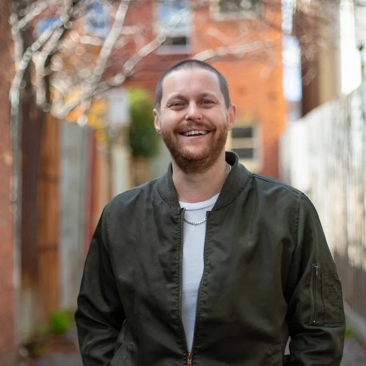
Council election candidates in BALACLAVA WARD

Candidates are rated on their record and their survey response. All the survey responses are HERE. Candidates are invited to fill out the survey here.

ALEX DARTON ⭐⭐⭐⭐⭐

Independent. Alex is a strong supporter of sustainable transport, and is personally an avid walker. He has spoken at Council in favour of protected bicycle lanes. How would he improve walking in Balaclava Ward? “Decrease the speed limit to 30km for vehicles on all municipal roads. Increase canopy coverage for shade in laneways en route via constructing archways overhead with deciduous vines grown up passive watered by aligned households grey water discharge. Increase planting of first succession nitrogen fixing native wattles in all remaining plots. And hold hands”. MORE INFO

RACHEL IAMPOLSKI ⭐⭐⭐⭐⭐

Rachel supports all the active transport actions in the Integrated Transport Strategy, and notes that for some of these, implementation is in the hands of State Government—- but strong advocacy from Council is still important. In her response to improving a route in her ward, Rachel focuses on how greening measures can improve walking “There are opportunities to boost tree canopy [..] to help make the walking experience more comfortable, and reduce the urban heat island effect.” She also notes how urban design can contribute to people (particularly women) feeling safer when walking.

MORE INFO. Facebook and Instagram @racheliampolskigreens

MICHELLE DI DONNA ⭐⭐⭐⭐

A black and white photo of a woman with a fringe and long hair.

Independent/PEPP. Michelle supports most of the active transport items in the Integrated Transport Strategy, though she thinks Inkerman St is “too narrow for bike lanes”. She supports widening footpaths and making walking more attractive. Michelle says “To be honest. As a newcomer to Council candidacy, I have not yet made a contribution to date, but now that I am aware of the Active Transport campaign, I think it is an excellent proposal. I would be willing to support any safe proposal”. A great open-minded approach! More info.

Council election index here. All council election blog posts.     

Responsibility for election comment is taken by J. Clutterbuck, Elwood.  Postal address c/o P.O. Box 4223 Richmond 3121

Council election candidates in ALMA WARD

Candidates are rated on their record and their survey response. All the survey responses are HERE. Candidates are invited to fill out the survey here.

justin Halliday ⭐⭐⭐⭐⭐

A man with very short grey and white hair wearing dark clothing

Independent candidate. Justin has been a key part of the campaign for greening Inkerman St through increased vegetation, more pedestrian crossings, and a protected bike lane. Justin designed and advocated for the Green Link project, a walking and biodiversity route along the Sandringham rail corridor from the Yarra River to Gardenvale; has successfully secured initial funding in Port Phillip and Stonnington, and work is underway in Glen Eira. The Green Link includes some cycling aspects, where there is the opportunity for co-located on-road cycling routes (not mixing cycling and walking). He’d like to see better pedestrian crossings on Alma Rd, to improve walking. MORE INFO.

DICK GROSS ⭐⭐⭐⭐

Dick Gross is a former mayor and councillor, and is often seen riding around town. As a councillor, Dick was mostly supportive of active transport, and was on Council when the excellent Integrated Transport Strategy was adopted. His key issue for this election is the poor transport planning around Fishermans Bend. “CoPP has been far too weak in advocacy. The failure of the State government to build the promised tram routes in Fishermans Bend has undermined what should be a huge housing opportunity.” He would like you to know: “I am the most prominent bike rider (apart from Janet Bolitho) that has served on Council. I ride everywhere and everyone knows that.” More info.

jOSIE FOSTER ⭐⭐⭐⭐⭐

A woman with long brown hair is standing in front of bushes with purple flowers.

Greens. Josie supports the active transport items from the Integrated Transport Strategy, though with respect to Inkerman St she notes that it’s important that a protected bike lane suits the needs of the community. She says: “I am a bike rider myself so I have an understanding of how much needs to be improved to make the roads safer for everyone.” More info

Port Phillip Council 2020-2024: Sustainable transport

‘Roads, rates & rubbish’ supposedly form a Council's core responsibilities. We focus here on the first: roads, and in particular Council’s record on sustainable transport.

Council began their term with an excellent transport policy, Move Live Connect: Integrated Transport Strategy 201-2028. This policy prioritised creating 10-minute walkable neighbourhoods; safe, connected and convenient active transport options; a focus on the transport needs of vulnerable residents; and boosting bike riding.

However very little progress on these aims have been achieved, with Councillors voting against key projects when the decisions are made. For example, the State Government proposed to fund the Shrine to Sea project, which Council policy described as one of the highest priority corridors for delivering protected bike lanes. The councillors voted against supporting this project.

Moreover, the ITS included some concrete progress indicators, such as number of daily walking trips. As of writing (11/8/24) the Council appears to have never published any of these indicators.

To give credit where it is due: this is a split council. Several councillors have worked consistently towards the goals of the transport policy. Some councillors are unable to move beyond the fantasy of everyone having copious on-street parking available at all times, and care nothing for those who do not drive, or who are seeking access to other options. And others are happy to talk the talk on sustainable transport, but consistently vote with those in the previous group.

We will discuss individual councillors in a separate post.

Sustainable transport goals* (from the Move Live Connect strategy)

Outcome 2:

Number of daily walking trips (measured by Vista): Goal 163k. NO PROGRESS INDICATOR PUBLISHED.

Number of daily bike riding trips (measured by Vista): Goal 35k. NO PROGRESS INDICATOR PUBLISHED.

Number of ‘Healthy Tracks to School’ - infrastructure improvements for safer walking routes to schools completed : NO PROGRESS INDICATOR PUBLISHED.

Number of bike corridors completed (of 11): Goal 7. Actual: 1 (Garden City Route). State Government has partially completed Moray St and St Kilda Rd. NO PROGRESS INDICATOR PUBLISHED.

Outcome 3:

Number of public transport trips (measured by Vista): NO PROGRESS INDICATOR PUBLISHED.

There are many opportunities here to address climate change, give people more inclusive transport options, reduce congestion, improve air quality, and green our streets. Let’s hope the next council can get to work on this!

*The goals here are interpolated from the 2028 goals.

Councillor report card: who supports residents when we're cycling?

Here we assess the legacy of the councillors on Port Phillip Council 2020-24.

Council’s strategy for improving transport options is the Move, Connect, Live , Integrated Transport Strategy 2018-28. As we’ll see below, many councillors have blocked implementation as each project is under consideration.

The key action from the policy is to create a network of protected bike lanes. Protected bike lanes are the most effective way to enable people to ride; about 70% of Port Phillip residents are interested in riding more, but are prevented from doing so because they don’t want to ride with heavy traffic.

The policy proposed that 11 protected bike lanes be built by 2028, with a further 2 afterwards. Another 2 were planned to be delivered by State Government. In 2024, only some have been considered by council and even fewer have been built. Specific issues affecting people on bikes are briefly described below.

Garden city off road connection: completed 21/22. A decision from the previous Council.

Park St link: Design for on-road protected bike lane between St Kilda Rd and Kings Way down-graded to a partially on-footpath design, to be completed by 2025.

Albert Rd to Kerferd Rd: planned to be delivered by State Government as part of the Shrine to Sea project. Council voted against the protected bike lane that was part of this project.

Inkerman St: Council voted against installing protected bike lanes in May 2024.

Pop-up bike infrastructure project: In 2022, VicRoads implemented a trial of pop-up bike and walking infrastructure. In December 2022, councillors demanded that the changes be removed. The trial was wastefully reversed before the data was analysed— despite user feedback indicating that some of the changes increased perception of safety, and high level reports that it reduced rat-running and increased ridership by 48%.

Councillor report card

TIM BAXTER: A stalwart supporter of active and sustainable transport. Greens. ☆☆☆☆☆

ANDREW BOND: Councillor Bond has proclaimed he’s “proudly part of the most anti-bike Council ever” and he generally votes this way too. Liberal. ☆

RHONDA CLARKE: Consistently votes against any initiatives that would promote cycling. Quote: “you can’t ride a bike with shopping, or to pick up kids, or if you’re elderly or disabled”. RoPP party. ☆

LOUISE CRAWFORD: Councillor Crawford has made cogent arguments in Council in favour of a systematic treatment of traffic issues, and has also been open to consulting with the community and coming to see conditions on the street. However her record in Council is patchy; she ensured Council avoided a discussion of the much-needed protected bike lane on Inkerman St; and also voted to remove the pop-up trial before data was analysed. Was not present for the Kerferd Rd vote. Understands the issues but will not take any bold moves to support people in her community to stay safe while riding. Labor. ☆☆☆

HEATHER CUNSOLO: Councillor Cunsolo is personally a confident and active cyclist, and has been open to consulting with the community about transport safety. This has not translated into any concrete action to keep people on bike safe, indeed during the Council discussion on Kerferd Rd she actively misled the community about the proposed designs (she stated that the surface would be inclined, which would be difficult for disabled people using trikes to use; this was not what was shown in the plans). A cyclist who consistently votes with the anti-cyclist lobby. Independent. ☆☆

PETER MARTIN: Like Cr Cunsolo, Cr Martin is personally an avid cyclist, but the difference is that Cr Martin acts to enable others to cycle safely. Genuinely works towards finding a positive outcome. Labor. ☆☆☆☆☆

ROBBIE NYAGUY: Since joining the council halfway throught he term to fill a vacancy, Cr Nyaguy has spoken passionately in favour of active transport and improving conditions for people on bikes. An uncompromising supporter. Labor. ☆☆☆☆☆

MARCUS PEARL: Consistently votes against any initiatives that would promote cycling. Liberal. ☆

CHRISTINA SIRAKOFF: Consistently votes against any initiatives that would promote cycling. RoPP party. ☆

Pop-up infra was actually fine, and increased bike riding and reduced rat-running

In a report to the Municipal Association of Victoria (archived here), the Department of Transport and Planning say that the pop-up infra installed in Port Phillip and several other councils was a success.

(For those who came in late, or have somehow managed to wipe this episode from their memory: with Council consent, state Department of Transport put in a “pop-up infra” trial, mostly sharrows and kerb outstands, some of which was good and other parts a little weird. Complaints about the changes were blown up by tabloid media and some Councillors. Council demanded that all the changes be removed, before the trial could be completed and any evaluation made. State DoT removed the infra.)

The report says the program:

  • Provided safer routes for people on bikes. “Across the program, 65% of 702 survey respondents say the pop-up bike lanes have improved safety, with 9% saying safety has become worse.

    People riding bikes were more likely to say the pop-up bike lanes had improved safety, compared to people driving or using public transport and people walking.

    Across all modes, more people said safety had improved.”

  • Increased rider diversity, with more women riding

  • Increased bike volume. “Across all sites, volumes of people riding bikes increased by 6% following the installation of the pop-up bike lanes.

    Ridership increased a further 11% between November 2022 and March 2023.

    By LGA, these changes ranged from a 48% increase in Port Phillip to a 9% decrease in Moonee Valley.”

  • Safer vehicle speeds attract more bikes. “Across the four areas with pop-up bike lanes, there is a correlation between bike rider volumes and motor vehicle volumes, with an increase in bike riders associated with a decrease in motor vehicles.

    Port Phillip performed best, with:

    - 48% increase in bike trips

    - 17% decrease in vehicle trips

    - 10 % decrease in vehicle speed

  • Reduced rat-running

This is a very high level report, with no details of the methodology used, and the short time that the infra existed in Port Phillip should mean that we take it with a grain of salt. However, we see that preliminary evidence existed to show that the trial was safe and successful, contrary to the scare-mongering promoted by councillors.

Why is Council not following the evidence and building safe transport infrastructure?

In a massive understatement, the report says one of the lessons learned is that stronger support is required at Executive and Councillor level to champion active transport objectives.

A part of the report.

The one remaining vestige of the trial (aside from the rough spots on the road where they had to physically remove painted bike symbols) is Marine Parade, where it is possible that the changes will become permanent—- depending on an upcoming community consultation. This is a state-controlled road, not a Council road.

The Beach Rd route is a special case— it’s heavily used by bunch riders, and when the protective bollards were first introduced, there were some crashes. The curbs (below) require that big bunches narrow down to 2 abreast. It would be good to see some data about whether these crashes were an artefact of the new arrangement, or whether the difficulty has persisted.

A road with concrete bollards marking off a bike lane, and green paint extending across the intersection.

Intersection of Marine Parade and Glen Huntly Rd.

[Updated on 28 July to reflect that the Marine Parade changes are not yet locked in, and have yet to be consulted on.]

Inkerman St safety corridor update: Council prioritises car parking over a safe bike lane

At the council meeting on 15th May, Council had a huge crowd in attendance, filling the gallery and overflowing into the lobby.

On the table were two options: Option A, a protected bike lane on Inkerman St. Option B, a painted lane. Both options had improved pedestrian safety, including 3 crossings, and much larger car parking spaces to accommodate SUVs. Option A would result in the loss of 114 car parks, while option B would result in the loss of 14 car parks. Both incorporated the scheduled resheeting of Inkerman Rd (which accounts for a substantial proportion of the headline costs).

Per the council documents, Option A had better safety outcomes and better aligned with Council policy, to encourage sustainable transport options. It was supported by slightly more people in the consultation phase than option B. Despite this, in the summary the council officers noted that “Local businesses are concerned that parking loss associated with Option A may adversely impact their business” and therefore recommended Option B.

The contention that replacing car parking with a dedicated safe bike lane would adversely affect business was not backed up by any data—- in fact studies from around the world conclude that this kind of intervention leads to streets that thrive more than nearby streets without (e.g see this article https://www.bloomberg.com/news/articles/2021-12-08/for-store-owners-bike-lanes-boost-the-bottom-line ).

There were around 60 speakers from the public registered, though in the end only around 40 spoke.

Jacob live-tweeted the public speakers here: https://twitter.com/Hailfromthepale/status/1790665119246295242?t=iAhxuIIT4hu5EOMzlwy_ug&s=19

Most of the comment was from people concerned about losing their parking. There wasn’t much engagement with the council report showing that there was adequate capacity on or near the street—- or perhaps just the thought of having to drive a little further was unacceptable.

There was also some great comment from speakers in support of the lane, including Pierre, a retired local who rides to the PCYC gym almost daily, the salvation army op shop, and Neighbours cafe. A health care worker who spoke passionately about the effect a serious crash can have on people’s lives. Henry (a primary school kid) who urged the councillors to think of the next generation. Rhonda was one of the other few speakers addressing climate change: “if not now when?” Jacob commented that as a Jew, there is a moral imperative to save lives; however saving parking is NOT a Jewish value.

In the Council discussion: Councillor Crawford moved that Option B be accepted. Crawford has previously been supportive of safe bike infrastructure, so this was disappointing. Councillor Martin said that in the case Option B didn’t get up, he’d move a hybrid option—- protected lane between St Kilda Rd and Chapel St, unprotected lane therefter. Councillor Nyaguy said that in the case that Option B was unsuccessful, he’d move to support Option A. Councillor Pearl advocated that the cost of Option B was too much. Councillor Clarke said that everyone has a right to park “as close as possible” to the front of their house.

Mayor Heather Cunsolo said that we should all take more responsibility as a community for keeping cyclists safe, including making head checks and doing the “dutch reach” (using the left hand to open the driver’s side door to avoid dooring). Note that in the Netherlands, cyclists are actually kept safe by separated bike lanes, modal filters, and low-vehicle environments. Relying on mindfulness is also not the Safe Systems approach— which views human life and health as paramount to all else, and “aims to create a system where mistakes and crashes do not result in death or serious injury”.

Option B was voted in. Voting in favour (I think): Crawford, Cunsolo, Clarke, Sirakoff, Bond, Baxter. Voting against: Pearl and Nyaguy. Abstaining: Martin. There was a division called.

A disappointing result. We had a chance to create a greener street, both in terms of actual vegetation and also one that supported sustainable and inclusive travel. We’ve missed that chance. Stay safe out there everyone.

Update 18/5: Port Phillip BUG has registered a formal complaint regarding the council officers’ recommendation for Option B. We believe this was unsupported by any professional expertise that the officers should have exercised; by the council’s policy objectives; and by the community consultation process.

Council fails to deliver on sustainable transport

Bike lanes are the latest conscripts in the City of Port Phillip culture wars: consistency and evidence are out.

Cycling is very popular in our city; most of us have a bike in the shed, and Port Phillip has the third-highest mode share in Melbourne [1]. Research research reveals that 70% of CoPP residents would like to ride more, but experience barriers--- chiefly, we don't want to ride with motor traffic [2]. Cities around the world have massively increased their ride share (and decreased air pollution and congestion) by building out protected bike lanes. Locally, the new lanes on St Kilda Rd have already increased ridership by around 300% [3].

In 2018, the council planned to build out a network of protected bike lanes over a decade [4]. This is a sparse skeleton of safe routes--- while everyone would be within 1km of a route, you may be riding the last 5 minutes home on shared neighbourhood streets. Back then, the bike lanes were the most popular among all the elements of the transport plan; in the review of the plan last year, protected bike lanes and intersections remained the popular actions for supporting people on bikes.

So this all sounds reasonable, right? Not according to some of our councillors: bike lanes are "popping up everywhere!" If only! The plan was for around 25km to be built by 2028; they've built only 2.5km of this.

According to one councillor, you "can't ride a bike if you've got groceries, small children, are elderly or disabled". Not only is this just wrong, it's missing the point-- having a bike lane nearby doesn't force you to use it, it just gives you more options. Even if you don't use it personally, it will get other cars off the road, leaving more space for you to drive and park.

Finally, to the claim that loss of parking will force small traders out of business. It's a reasonable fear, but there's no evidence for this: council studies show that remaining nearby parking will be adequate. The evidence is in the other direction: walking and cycling improvements can increase retail spend by up to 30% see e.g [5]. Similar studies also show that traders consistently overestimate the role that parking has in their success [6]. According to Shane Gardner, manager of bath house Wet on Wellington (City of Yarra) new bike lanes would "put 30 jobs at risk"--- that was 10 years ago. Now, the busy Wellington St bike lanes are rated as one of the safest places to cycle in the city--- and Wet on Wellington is still in business.

Last Wednesday, Council voted to replace the flagship bike lane policy with a weaker plan to make a "range of interventions" like painted bike symbols, sharrows, kerb outstands and street art. The thing is, when the DoT put exactly such a range of interventions in our streets two years ago, this very council demanded that they be ripped out.

On Wednesday, Council voted to "advocate to State Government to deliver protected bike corridors". Again, when the State Government proposed a protected bike corridor along Kerferd Rd (including substantial funding), this council advocated against it.

In a culture war, consistency goes out the window.

Cr Bond says "I'm proud to be part of the most anti-bike Council in Port Phillip's history", but the whole community is missing out: on state government investment in road safety, on reducing transport carbon emissions, on better health through active transport.  And our kids are missing out on the simple pleasure of riding independently.

[1] Beck, Ben, et al. "Spatial variation in bicycling: a retrospective review of travel survey data from Greater Melbourne, Australia." (2021).

[2] Pearson, Lauren, et al. "Barriers and enablers of bike riding for transport and recreational purposes in Australia." Journal of Transport & Health 28 (2023): 101538.

[3] Department of Transport and Planning, Bicycle Counter Data. Link to latest stats.

[4] Move, Connect, Live, Integrated Transport Strategy 2018-28

[5] Transport for London, Walking and Cycling Economic Benefits summary pack, https://tfl.gov.uk/corporate/publications-and-reports/economic-benefits-of-walking-and-cycling, and further references therein.

[6] Note to Store Owners: Not All Holiday Shoppers Drive, D. Zipper, Bloomberg, 9 Dec 2021, https://www.bloomberg.com/news/articles/2021-12-08/for-store-owners-bike-lanes-boost-the-bottom-line

Supporting the Bicycle Users Group

To support the Port Phillip Bicycle Users Group, the best option is to become a member: you can join here. Single membership is currently $20/year.

The BUG community also includes a bigger group of people who come on rides, or subscribe to our email newsletter (sign up here), or follow our social media (facebook, Insta, twitter, mastodon).

If you participate in Bicycle Network bicycle counts, you have the option of directing your donation towards a group of your choice— thank you to the BUG supporters who choose us!

We’ve also been generously supported by donations (our campaigns have been substantially funded by private individuals). If you’d like to support our campaigns then please send an email to arrange.

In 2020 we were the recipients of a City of Port Phillip community grant for the project On Your Bike. In 2021, 2022, 2023 we received funds from the CoPP in recognition of our support for the Ride to Work day.

Thanks to everyone who is part of our movement, it’s great to ride together.

INKERMAN ST BIKE LANES: Concerns addressed

Concern: Separated bike lanes create more traffic congestion.  

Answer: More transport options means less people NEED to drive. This reduces congestion. Less congestion means faster trips for all— including drivers. And better transport means more patrons to support our local businesses.

Most urban trips are less than 5km, a distance that can easily be covered by a number of  micro-mobility and active transport options such as bikes and scooters.  

Concern: All trees and existing vegetation will be removed.  

Answer: On the contrary, as part Option A, a net of 26 trees will be added to streetscape, increasing tree  canopy cover and biodiversity while providing shade, passive irrigation, and improved water quality.   The reallocation of space away from cars will help in reducing air pollution, but will also contribute to a healthier  and more sustainable urban environment.  

Concern: It creates access issues for emergency vehicles.  

Answer: With careful planning and thoughtful design, separated bike lanes can coexist seamlessly with emergency  access requirements.  

With Option A, there is no central barrier on the road, emergency vehicles can travel centrally on the road with  vehicles pulling to the side when required. Additionally, the proposed lanes are wide enough (2.2m “SUV-wide”)  that smaller vehicles can also go through them in emergency situations.  

We can look abroad for additional evidence. The city of Paris has seen the average response time for  emergencies falling below seven minutes, with firefighters and first-responders attributing it to the city’s  recent deployment of cycle paths.  

Concern: Separated lanes are dangerous because cars sometimes turn into the lane at  intersections without looking.  

Answer: It is very important to make intersections safe for all vulnerable users of the road.  Option A comes with protected intersection designs which include curb extensions to prevent cars from turning  into the lane without looking, signalling improvements to give pedestrians and cyclists a head start, as well as  road surface markings providing clear visual indication of a potential conflict point.  

Concern: This is for people who don’t even live here.  

Answer: This project responds to ongoing local safety issues and personal injury risks experienced by the  community and seeks to increase local transport choices. It supports local connectivity, giving people the  choice to walk or cycle to nearby safely destinations, including shops, parks and services.  

Concern: This is for cyclists, and not everyone can ride a bike.  

Answer: This project is about making Inkerman safer for all vulnerable users: pedestrians, kids, active transport  users, but also people who rely on mobility aids or devices such as wheelchairs, walkers or strollers. Informal mid-block crossing is difficult for people with limited mobility as they may be required to navigate level  changes and moving traffic. As part of Option A, new raised pedestrian crossings with flashing lights are proposed  to make it safer and easier for people of all abilities to cross Inkerman Street.  

Furthermore, all the existing accessible parking spaces on the south side of the road will be retained.

Do the Councillors even know that you exist?

“You can’t ride your bike and bring home your groceries. You can’t take your kids to their dance classes, or bring parcels home, or use the bike if you’re elderly, disabled or infirm.“

City of Port Phillip councillor, meeting of 18th October, in discussion of the Inkerman St protected bike lane. (Webcast at around 1:05)

If you’d like to help educate the Councillors, please send us your photo or a short video of you riding with kids, parcels, groceries, or while elderly, infirm, or disabled. Don’t forget to mention how protected bike lanes would help in your everyday life.

Email is portphillipbug@gmail.com.

More about our Inkerman St campaign.

How to contact the City of Port Phillip councillors

To fix a small issue like a pot hole or missing curb ramp, the fastest way is the use the app Snap Send Solve. If the issue isn’t resolved quickly, email portphillipbug@gmail.com and we’ll follow up at our regular meetings with Council officers.

But sometimes we need a BIG ISSUE fixed: we need a safe route to school, or a protected bike lane. Time to email our councillors!

Why we need a protected bike lane on Inkerman St

Inkerman St is one of the most dangerous routes in Port phillip

This is not just for people on bikes, but also for pedestrians and drivers. In the 5 year period to 2022, 33 crashes were recorded, with 13 involving bike riders and 10 involving pedestrians [1]. The plans for a protected bike lane also include the option of slowing traffic down to 40km/hr and incorporating extra pedestrian crossing points, which should improve safety for all users.

A painted bike lane is not consistent with road design guidelines for a road this busy

There are around 6300 vehicle movements in each direction daily along Inkerman St [2]. Australian roads guidance is that a road with this level of vehicles, and speed limit 50km/hr, should have segregated lanes [3].

An image showing

BIKE LANES ALLOW KIDS AND YOUNG PEOPLE TO TRAVEL INDEPENDENTLY

Young people need to get around: to go to school, to visit friends and family, to get to sports and other activities— to live their lives as full members of our community. If they can ride or scooter safely, they can get out of ‘mum’s taxi’ and develop their own independence.

To reduce air pollution

Air pollution in East St Kilda is well above WHO safe air recommendations: a recent Guardian report estimated the PM2.5 levels as 7.4 µg/m3 [4]; the safe air recommendation is less than 5 µg/m3. By encouraging a modal shift towards less polluting modes of transport, we can improve the air quality, particularly for people living directly alongside very busy streets.

A map showing air quality estimates in Melbourne suburbs.

To fill in the missing link for travel to and from the south-east

There are very few protected bike lanes for travel to and from the south-east of Melbourne. Gardiner’s Creek trail is about 4km north of Inkerman. The Bay Trail is about 4km south. With a bike lane along Inkerman St and Inkerman Rd, the new St Kilda Rd bike lanes would join with the Djerring Trail (under the sky rail), allowing convenient access from the city, through East St Kilda, to Caulfield and beyond to Dandenong.

This missing link is a vital part of the network!

Update: Kerferd Rd bike lane August 2023

The Shrine to Sea project is starting consultation on their (much downgraded) masterplan, with the bike lane removed.  

Also, this Wednesday, the Port Phillip Council is deciding on what their position will be.   They have identified 3 options:  1. advocating for no bike lane, 2. advocating for the protected bike lane, or 3. advocating for a bike path in the median strip.  The report before council  clearly lays out that Option 1 does not address the significant safety issues already existing on the corridor, and Option 3 will lead to more substantial traffic disruptions.    On the other hand, Option 2 is consistent with achieving a more sustainable city, with liveable streets for everyone to enjoy. 

Despite the clear path forward here, I expect some Councillors to continue to amplify the scare campaign run by a small number of residents.   

Please come to Council this Wednesday 16th August (either in person or online) to make a short statement about how the bike lane would be good for you.   To do this, fill in the Request to Speak form by 4pm Wednesday, for agenda item 10.1.  If you don't feel comfortable speaking, your presence in support would be wonderful.   The meeting is at St Kilda Town Hall, 6.30pm.  Public comment is at the beginning, so you should be finished by 7.30pm.    

And if not, you can write to your local councillors--- email addresses are here. 

Separate to Council, the Vic Government is consulting on their draft masterplan (the one that had the bike lanes removed). To ask for their reinstatement— please fill in the survey at https://engage.vic.gov.au/shrinetosea.

Update: the outcome of the August council meeting was that the Council decided not to support the protected bike lane on Kerferd Rd. Voting for this were Cunsolo, Clarke, Sirakoff, Bond, Pearl. Supporting the protected bike lane were Baxter, Nyaguy, Martin, Crawford.

Community opening of the St Kilda Road bike lanes!

Join us to celebrate the long-awaited bike lanes! 11am Sunday 27th August. Location: the park next to M-pavilion, opposite the National Gallery of Victoria.

Two people riding in a bike lane protected by a curb.  It is a sunny day with trees on both sides.

Please come and celebrate. If you can, bring fun things to share (cake, kids activities, things to decorate our bikes…). This event is hosted by Port Phillip Bicycle Users Group, Stonnington Bicycle Users Group, and Bike Melbourne. The event doesn’t have government or corporate sponsorship so the celebration is up to us!

Ride in together from Brunswick with Merri-bek BUG: details here.

Ride in together from St Kilda with PPBUG, leave 10.15am from Cleve Gardens (bottom of Fitzroy St).

Ride in together with GEBUG, leave 9.30am Glen Eira town hall.

After the opening, there will be a ride down to the junction and back.

Update on Shrine to Sea project, July 2023

In May, the Shrine to Sea project announced that they were separating the protected bike lane from the project:

In reviewing the draft masterplan, the Victorian Government considered a number of issues, including the Department of Transport and Planning’s decision to remove temporary Pop-Up Bike Lanes from the City of Port Phillip, and decided that further targeted engagement is required for a safer active transport solution along Kerferd Road. For this reason, the protected bike lane is being separated from the Shrine to Sea masterplan to be considered at a future time.

Recall that the community consultation panel recommended the separated bike lane, and the objectives of this project were to:

  • Enhance the green boulevard

  • Create safer and clearer links and connections for walking and cycling

  • Celebrate local stories

  • Improve usable open space

In June, the Port Phillip Bicycle Users Group met with the project team to find out more about this decision and the way forward.    These are our questions and the answers.

What happens next?

The draft plan will be released for public comment as soon as possible.  It will not include the separated bike lane. 

How can the separated bike path be built?

There will be a targeted "robust engagement process" around the bike lane at a future time and the State government is currently discussing the pathway forward.  The design proposals included in the draft plan have been carefully considered to make sure they don’t restrict future options that could be included in the engagement process. The $13M budget was never intended to cover all the masterplan costs.  It will help deliver many elements in the plan but there will be a need for additional funds.  This is also partly due to the increase in costs since the start of the project.   

Usability of footpaths and use of the footpaths by scooters/bikes are key concerns of pedestrians, particularly disabled users (per Vision Australia) and older people (per Victoria Walks).  Pedestrians currently have difficulty crossing Kerferd Rd.  How are these concerns being addressed under the revised plans?

The masterplan can’t address use of existing street footpaths as these are matters for the Council or relevant land managers. Nonetheless accessibility and safety principles are key to the designs in the draft. The proposed protected bike lane design did include improved accessibility solutions and safer crossings on Kerferd Road, and this will now be dealt with in the future engagement process.  

Kerferd Rd, looking towards the sea

What happens to the design work undertaken on the 5 options for the bike lane that S2S has done, including the Healthy Streets assessment, the Shrine to Sea metric criteria assessment,  community feedback, and traffic modelling--- will this be released?

Reports and assessments completed for the 5 options, including all the renders, plans etc will be passed on to the next state government project team that gets the responsibility for progressing this. DEECA had intended to release the reports with the draft masterplan when it included the protected bike lane, but these will now form part of the next engagement process.  The state government wants to make sure there is an engagement process in place for this as some of this material is technical and requires support in explaining or interpreting the information.

Current plans are to re-open the Herbert St crossover when the S2S plan is complete.   This is one of the identified high crash locations.   Will this stay closed or re-open?   

The proposed design solution for the Herbert Road crossover will be in the draft plan so everyone will be able to provide feedback at that time. DEECA has worked with Council closely on the design proposal.

What will the "robust engagement" process be?  

There will be a targeted engagement process, with opportunity for some mythbusting and shared information.  More info about car parking, bins, traffic flows. The precise nature of the engagement is not yet known.

Critical Mass June 2023: text of the speech by Dr. Paula Hanasz

A group of cyclists in rainy twilight.  A tall man in an overcoat and bike helmet is in the foreground.

June’s Critical Mass started at Fed Square. Image credit: Faith Hunter.

I'm not here because I'm a cyclist.

I'm here because I'm a citizen.

Because I'm a taxpayer.

Because I'm a parent.

And because I'm outraged that our state and local governments continue to endanger me and my family by refusing to invest in separated bike lanes and accessible public transport. 

I'm outraged by the hypocrisy of government rhetoric about active transport and no meaningful expansion of people-centric infrastructure.

A video showing bikes from behind with blinking red lights. In the centre of the shot is a woman on a trike. Credit: Faith Hunter.

My family and i are doing our bit for this city by deliberately not having a car,

by living in and contributing to a 20-minute neighbourhood.

But the state and local governments do not make this easy for us.

They do not make it affordable. 

And they do not make it safe.

For all the money being pumped into roadworks and the level crossing removal projects, the narrative is still around improving safety and convenience for cars.

But my bike IS my car.

I use my bike - this bike - to take the kids to and from school and daycare every day.

I ride this bike to and from work.

I ride this bike to and from the shops.

I ride this bike to and from parks and picnics and parties.

I ride this bike for exercise.

I ride this bike to clear my head.

And i ride this bike as a statement of my commitment to being the change that i want to see in the world.

But i ride scared.

I ride scared of being hit by a car on Melbourne's major thoroughfares that do not have separated bike lanes.

I ride scared of being doored on smaller, residential streets that i need to ride on to get to the major thoroughfares.

I ride scared of hitting a pedestrian on the shared bike and pedestrian paths.

I ride scared of getting pulled up for riding on a busy footpath because i have no safe alternatives.

But this isn't about me.

This is about us all Melbournians, whether we are here tonight or not.

Separated bike lanes protect everyone. 

Nobody wants to be the cyclist hit by a car.

But also nobody wants to be the driver who hits a bike.

Even if you yourself have no interest in riding, chances are you order food or groceries that are delivered on a bike or scooter. Don't you want them to get to your door safely?

Traditional bike lift down at Kerferd Rd Pier! Image credit: Freya Clough.


More separated bike lanes means fewer bikes and scooters weaving in and out of traffic, endangering us all.

And there are going to be more and more bikes and scooters on our roads.

There already are!

Janet Bolitho addresses Critical Mass at Kerferd Rd Pier.

The increase in bikes and scooters in our city is not just because of greenies like me wanting to reduce their carbon footprint.

It's because of everyone who can no longer afford to have a car.

It's because of the boom in businesses using bikes and scooters for deliveries.

It's because of the expansion of ebike and escooter rental schemes. 

It's because having wide-spread, accessible, and safe active transport options makes sense for a dense, modern, and flat city like Melbourne.

This shouldn't be a problem.

This should be an opportunity.

It should be an opportunity for our state government and local councils to put our money where their mouth is; 

to prioritise active transport;

to listen to us citizens, us voters, us taxpayers, us drivers, when we say we need an extensive fit-for-purpose network of separated bike lanes across all of Melbourne.

Paula giving her speech at Kerferd Rd Pier. Photo credit: Danielle RG.

And we need it now!

Thank you.

Community support for separated bike paths on Kerferd Rd

Press release here.

A diverse range of community and not-for-profit groups are calling on State Government to construct a safe bike lane on Kerferd Rd.   This would have many benefits for the whole community.

A separated bike lane would

  • Encourage scooter users off the footpath, ensuring that footpaths remain usable for pedestrians, particularly older people and people with a disability 

  • By making it possible for more people to ride, play an important role in improving cardiovascular health

  • By making it possible for more people to ride, reduce transport emissions that contribute to climate change

  • Enable kids and young people to make safer independent journeys to school and around town

A separated bike path along the length of Kerferd Rd-Albert Rd corridor was a key recommendation of the community panel for the Shrine to Sea project.  The panel made their recommendations after a year-long deliberative process.

A separated bike path on this corridor is supported by:

  • The Heart Foundation

  • Victoria Walks

  • Port Phillip Emergency Climate Action Network (PECAN) 

  • Bicycle Network 

  • Port Phillip Bicycle Users Group

  • Disability Resource Centre

  • Better Streets Australia

  • Port Phillip Ecocentre and Port Phillip Baykeeper

A group of about 15 people standing on the grassy median of Kerferd Rd.   It is sunny and the trees have autumn leaves.  There are about 4 bikes, a baby, and a dog.

Supporters of a protected bike lane gather on Kerferd Rd.

QUOTES:

“Kerferd Rd is an extraordinarily wide corridor, with ample room for people walking, on bikes, driving and parking.  A separated bike lane would be a wonderful community asset that gives people more options for sustainable travel.  It would connect Anzac station and the new St Kilda Rd bike lanes, Albert Park, and the beach.”   

Port Phillip Bicycle Users Group president, Julie Clutterbuck.  

“The Heart Foundation supports the construction of protected bike lanes on Kerferd and Albert Roads. Active transport plays an important role in improving cardiovascular health. However, many are put-off cycling on busy roads with high levels of traffic where there is a greater risk of collision between cyclists and vehicles. Installing a separated cycle lane on Kerford and Albert Roads would help reduce potential collisions and provide cyclists with a safe and convenient way to travel by bike, making cycling a more attractive option for everybody.”

Peter Thomas, Heart Foundation National Manager,  Public and Local Affairs

Victoria Walks supports the construction of protected bike lanes on Kerferd and Albert Roads. Research has demonstrated that people walking, especially older people and those living with disability, are often intimidated sharing paths with bikes. When we surveyed seniors on walking – generally, not specific to shared paths or cycling – and asked what measures might improve feelings of safety, the top rating suggestions were:
1. Better cyclist behaviour on shared paths
2. Reduce cycling speed on shared paths

The reasons for providing separated paths are further explained in Victoria Walks’ position statements on shared paths and footpath cycling and associated background research.

The increasing popularity of e-scooters, e-bikes and other emerging devices means that attractive, separated bike lanes will only become more essential to support those transport options and ensure that footpaths remain usable for pedestrians, particularly older people and people with disability.”


Dr Ben Rossitor, Executive Officer, Victoria Walks 

“The Port Phillip Emergency Climate Action Network (PECAN) supports the construction of protected bike lanes on Kerferd and Albert Roads. This very wide corridor has ample space to share for people walking, cycling and driving safely.  We know that well-designed and networked bike lanes will increase cycling, giving Melbournians more options for sustainable active transport.   


With the recent boom in e-scooters, attractive, separated bike lanes are also essential for ensuring that footpaths remain usable for pedestrians, particularly for older people and people with disabilities.”

Rhonda Small, for PECAN Co-ordinating Group    pecan.org.au@gmail.com

“Kerferd Road is a broad boulevard through the beach-side suburb that has plenty of road space for high quality bike infrastructure.   And just as critically, the route is also mapped as a Strategic Cycling Corridor (SCC) in the government’s plan for Melbourne’s arterial bike facility network.  It runs from the Albert Park Beach to the future new Metro underground station, which is just a few years from being operational.

Bike transport is no longer discretionary.  The Kerford and Albert Road corridor has been years in the planning and is part of multiple strategies which have been subject to much review and consultation.  It is incumbent on the government to proceed swiftly, efficiently and with singular purpose.”

Bicycle Network, www.bicyclenetwork.com.au

"The BetterStreets for Victoria and Australia coalition supports the construction of protected bike lanes on Kerford and Abbott Roads. These bike lanes would support our coalition members vision for safe, healthy, people-friendly, climate-friendly streets that are accessible to all of us, to give people more options to move around safely and enjoyably. When would be a good time to make streets safe for our children? If not NOW, when? The time to choose better is now. The benefits to the community go beyond just local children, teenager, and elderly independence - these corridors would elevate tourism, access to key destinations in Melbourne and Port Phillip generating significant economic activity to local businesses."

Dr. Megan Sharkey, Board, BetterStreets for Victoria and Australia

Port Phillip Ecocentre and Port Phillip Baykeeper

“Port Phillip EcoCentre wholeheartedly supports the construction of protected bike lanes on Kerferd and Albert Roads. Availability of well-designed and networked lanes for bikes and scooters will increase choice of these modes of transport, reducing our collective carbon footprint. 

Well defined lanes clearly separating transport modes will increase safety: reducing conflict between cyclists/scooters and cars on roads, and with pedestrians on footpaths; resulting in less stress for all concerned. Provision of sustainable active transport options to the beach, will also promote personal wellbeing through more time spent enjoying our beautiful Port Phillip Bay.”

Neil Blake, Port Phillip Baykeeper.

Background on the Kerferd Rd bike lane at the Port Phillip Bicycle Users Group blog.



Turning the corner on Chapel St

Hopefully this is not just turning the corner literally—- from Chapel St into Alma Road, at the end of the March Critical Mass ride—- but we also turn the corner to a new direction for safe and fun riding on Chapel St!

Kerferd Rd bike lane (update April 2023)

TAKE action:

Write to your representatives! contact details are here.

The history

2018: The City of Port Phillip’s integrated transport strategy Move Live Connect designates Albert/Kerferd Roads as a priority bike route. CoPP prepares a Kerferd Rd safety trial, including a protected bike lane, supported by extensive traffic modelling.

However in the 2018/19 budget, the State Government committed $13m to the Shrine to Sea project, upgrading the Albert Rd/ Kerferd Rd boulevard including active transport links.

In the face of this, the Council decided not to proceed with their own trial.

The Shrine to Sea project has proceeded glacially, with extensive community consultation.

Over 2020-2021, a community panel met, considered evidence from subject matter experts, and together developed a vision for the boulevard. Among a suite of thoughtful recommendations: “Bike lanes to be interconnected for the entire length of the boulevard; Use landscaping to define a separate bike pathway on Kerferd Road to isolate bikes from cars.

Kerferd Rd bike lane, 2020

Pop-up lanes project

In 2022, VicRoads announced that as part of their pop-up bike lanes project, “40km of new and protected bike lanes” would be installed in the City of Port Phillip. Most of this was so-called “light touch” measures: renewing paint on existing on-road lanes, wayfaring signs, and speed humps.

The single substantive measure was a trial of a parking-protected bike lane on Kerferd Rd, between Richardson St and Canterbury Rd. This would include a bollard protected bike lane under the light rail near the Albert Rd/Canterbury Rd intersection. Protection from cars is essential on this stretch of road, as can be seen in the photo below.

In April 2022 VicRoads announced that following “community consultation” the trial would not go ahead.

View of the road under the light rail line, with a car partially driving in the bike lane.

Google streetview of lightrail underpass, showing a vehicle veering dangerously into the bike lane

Current situation:

The Shrine to Sea team is supposed to be releasing a draft plan in “early 2023”. They have been evaluating “5 different bike lane and road configurations”. As this is a Council road, council’s support is required for the project to go ahead. While some councillors have made their support for a protected bike lane clear, others are opposed to any changes. The support of Mayor Heather Cunsolo, who “talks the talk” on cycling, will be crucial.

Planning context

Kerferd Rd is an extraordinarily wide boulevard. At about 60m wide, it is similar to St Kilda Road, but has no tram lines or high density buildings. Few inner city streets offer such ample space for introducing simple safety improvements. There are two vehicle lanes in each direction, a very wide grassy median and a mix of angle parking and parallel parking against the curb. There are almost no driveways. After Canterbury Rd the boulevard is called Albert Rd, and runs alongside Albert Park, with service roads for much of the length. At the south-west end is the sea, at the north east end is the Shrine of Remembrance and the Domain. There are extensive sporting facilities in Albert Park, and nearby schools include Middle Park Primary, Albert Park Primary, South Melbourne Park Primary, and MacRob Girls High School.

Kerferd Rd is not a VicRoads declared road although Albert Road is. The Albert Rd/Kerferd Rd route is a State Strategic Cycling corridor, which are “the most important routes for cycling for transport”.

A map of strategic cycling corridors, showing Kerferd Rd

Strategic cycling corridors, December 2020

Albert Rd/Kerferd Rd is route 2 on the City of Port Phillip’s bicycle network, and has been identified as a high priority by Council for many years.

The need

Council’s original plan for Kerferd Rd identified the need for improvement here:

Kerferd Road has a very high number of crashes compared to other Council-managed roads in Port Phillip. Between 2016 and 2020, there were 24 recorded crashes along Kerferd Road. Of these, 11 involved cyclists; three received serious injuries. This site has the second highest number of crashes in the City of Port Phillip. This crash data has been provided by the Road Crash Information System (RCIS). This system is maintained and operated by the Department of Transport and Victoria Police.

Kerferd Road is a key link for bike riders and connects the Bay Trail bike path to the off-road paths in Albert Park Reserve, the new Anzac Station and to the proposed upgraded bike facilities on St Kilda Road and Moray Street.

Strava heat map shows high use  by cyclists

Heat map from Strava shows existing heavy bike use of Kerferd Rd, similar to St Kilda Rd or Beaconsfield Parade

What the experts say

Separated bike lanes are essential for better mental and physical health: the Heart Foundation says that Victoria should be investing in separated bike lanes improve health, as well as support local businesses, save households money, and provide independence and freedom, especially for children, teenagers, the elderly and people with a disability. They estimate that $13 would be returned in value for every $1 spent.

Separated bike lanes make financial sense: Infrastructure Victoria says “if we provide alternatives that get more cars off the road, everyone benefits. For drivers, it means less time in traffic and travelling to the city becomes a better experience. For everyone else, the environmental and productivity benefits are huge.” An increase of 55% of people choosing to cycle is achievable and could save every inner Melbourne car driver around 18 minutes in traffic per week.

People with disabilities need bike lanes to get scooters off the footpath: Vision Australia advocacy manager Chris Edwards said vision-impaired Victorians were concerned about being hit by riders or tripping over parked hire scooters. “[In] our view there’s not the infrastructure that supports [scooters] – bike lanes, appropriate places where you can park the scooters so they’re not a hazard – still hasn’t caught up. Without [that]... they’ll be an ongoing issue.” Age article, Jan 2023.

Community views

Broad-based surveys of Port Phillip residents consistently reflect support for protected bike lanes (the pop-up painted bike lanes by the DoT in 2022, on the other hand, were controversial). For example, the most popular element of Council’s Integrated Transport Strategy was “Deliver a network of dedicated and continuous priority bike lanes to create safer routes for all ages and abilities”. Surveys completed in 2018 by the City of Melbourne found that 83% of respondents living in Melbourne and adjacent municipalities (including City of Port Phillip) would aim to ride if a protected bike lane was provided compared to 22% who say they would be confident to ride on conventional painted bike lanes (without buffers).

More community views (from Heart Foundation, Victoria Walks, PECAN, and others) in a joint statement here.

The concerns raised by the anti-bike lane lobby include: “Safety - a bike track between the walking path, nature strips and the road, puts the residents at risk of tripping over the concrete bollards. Many residents along this road are elderly and transition from car, pathway and then into their property and they would be at more risk if this plan goes ahead.  Duplication - There is already a bike path for our 'much loved' bike riders. Even bike riders will not benefit from these changes. Parking - Albert Park residents pay a fee to the City of Port Phillip council to park out the front of their own homes. Yet, this plan will reduce current parking for Kerferd Rd residents.  Traffic chaos- Kerferd Road currently does not have any traffic issues. One lane WILL cause traffic to bank up at the lights at Beaconsfield Parade. Expenses - it is believed that finance (in excess of $12-16m) has already been earmarked for this project with the Victorian State Government. “

These claims are either entirely without evidence, can be mitigated by good design, or are just the cost side of the ledger, without considering the benefit side. For example: while some car parks may be lost over a rather long stretch, car parking has been prioritised under most suggested plans, and almost all of it will be retained. For example: Kerferd Rd does have traffic issues, not only the safety issues mentioned above but also hooning. Traffic modelling specific to Kerferd Rd indicates that reducing the road to one lane will not induce “traffic chaos”. For example: the expense of cycle lanes is off-set by improved public health, reduced traffic congestion, improved air quality, and reduced greenhouse emissions.

Inkerman St safe cycling corridor background

Inkerman St is one of the routes identified in the City of Port Phillip’s Integrated Transport Strategy to be prioritised for protected safe cycling. It is also classified by the Victorian government as a strategic cycling corridor.

Map of the bicycle corridors included in the Integrated Transport Strategy

In May 2021 Port Phillip council officers prepared an update on the Inkerman Safe Travel Corridor. Inkerman St between Orrong Rd and Fitzroy St was identifed as the highest priority bike corridor for council delivery.

Factors influencing this include:

  • As a connector between the (soon-to-be-completed) St Kilda Rd separated bike lanes and Caulfield station/ Monash Caulfield/the Djerring trail (under the skyrail on the Dandenong line), this is of high strategic value

  • This street has a poor safety record, with 50 crashes recorded in the 5 years to 2019, 16 involving bike riders and 17 involving pedestrians.

  • The existing narrow painted bike lanes do not mitigate the safety risks to bike riders.

  • Usage of the corridor by people on bikes is high and increasing.

OPtions for the safe cycling corridor

This report presented three options for improvement. (A fourth option, a bi-directional path on one side of the road, was not pursued due to low safety benefits.) The italicised text and images following are from the report.

Option 1: Wide protected bike lanes with parking on one side of the street

Street cross section, showing (from left to right) footpath, a tree, a bike lane, a buffer zone, a parking bay, two traffic lanes, bike lane, a tree, a footpath.

Option 1 separates the bike lane from parked cars with metre wide islands at kerb height that provide a place for passengers to enter or exit a parked vehicle. This is the safest option for all users. Inkerman Street is wide enough so that, with the removal of the central median, the bike corridor can be included without reducing the number of cars that can drive on the road.

Option 1 will require 124 of 189 parking spaces to be removed.

Option 1 is the safest option for bike riders and Council officers recommend developing a concept for this option.

Option 1 is the preferred option for keeping the street open for everyone to use: people on bikes, scooters, and e-bikes, travelling at different speeds, can easily share the bike lane. By making the protected lanes attractive for all these users, it also keeps the traffic lane free for faster-moving (40km/hr) vehicles.

Option 2: Narrow kerbside bike lanes with parking on both sides of the street.

Street cross section showing (left to right) footpath, bike lane, parking bay, two traffic lanes, parking bay, buffer, bike lane, footpath.

Option 2, like Option 1 is a kerbside bike corridor with a protective kerb. Option 2 retains more parking by reducing the width of traffic and bike lanes. This will limit areas where faster riders (including e-bikes and e-scooters) can overtake to breaks in the separator kerb including areas where there is no parking, at intersections, or they may ride in the traffic.

While Option 2 retains parking on both sides of the road, about 46 parking spaces will be removed adjacent to driveways to provide sightlines between drivers and bike riders. In addition, up to 20 spaces will be removed to support turning movements and avoid reducing intersection capacity.

Option 3: Painted buffers without a physical barrier.

The third option uses painted buffers rather than a physical barrier (low kerbs). While bike lanes with painted buffers on both sides are safer than the current painted bike lane, they do not provide a physical barrier between moving or parked cars and people riding bikes.

City of Melbourne surveys found that 22% of respondents would be confident to ride on typical bike lanes painted on roads, 46% of would aim to ride if double buffered bike lanes were provided while 86% of respondents would ride in protected bike lanes.

Buffered bike lanes require a maximum of 50 parking spaces to be removed to improve sightlines at driveways and intersections.

What about the glen eira section?

Inkerman St is in the City of Port Phillip up to Hotham St. Between Hotham and Orrong Rd it is shared between the City of Port Phillip (north) and the City of Glen Eira (south). East of Orrong it is in Glen Eira (and then named Inkerman Rd).

The City of Glen Eira’s transport strategy has a target of 50% of all trips to be taken by non-car transport by 2031. However this is purely aspirational, with few actions to support it. The main action for cycling was to “Plan and design a pilot cycle corridor improvement project with a protected cycleway to encourage an increase in cycling.” The location chosen for this corridor was Inkerman Rd, which shares the same strategic benefits as the connecting Inkerman St.

Anti-bike lane campaign Starting in 2019, there was a concerted anti-bike lane campaign by some residents of Inkerman Rd. Key concerns were safety and loss of parking (as well some other expressed concerns such as people from outside the area using “their” street). The campaign was very heated, with councillors requesting that they not be harassed by people opposing the bike lanes.

In November 2022 Glen Eira Council officers released a massive report (over 500 pages) on the Inkerman Safe Cycling Corridor Trial. They recommended a bi-directional bike lane on one side of the road. (This was probably due to it requiring fewer car park removals, despite this lay out being identified by Port Phillip as having lower safety benefits for bike riders).

On 22 November, the Council carried a motion that Council “Ceases all work on the project and no longer proceeds to community consultation”. The motion was carried 5/4 with the support of Crs Esakoff, Magee, Cade, Parasol and Zmood.

Current situation

While the eastern section in Glen Eira is a lost cause with the existing Glen Eira Council members, in Port Phillip between Hotham and Fitzroy St we can still choose to make a street that is open for everyone to use.

As of writing (March 2023) we are waiting for the Port Phillip Council to consider the concept designs prepared by Council officers. After that, it will go out to community consultation.